In May/June 2019, I am cycling the length on Britain, visiting all the places that I have lived and a few friends along the way. This is a charity ride aimed to raise funds for Alzheimer's Research UK and the Spinal Injuries Association. I will also have fun looking for various features along the way and exploring the meaning of memory
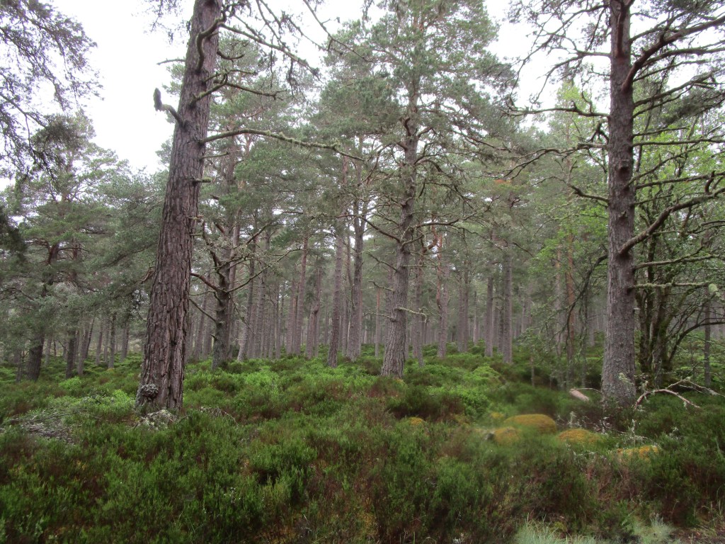
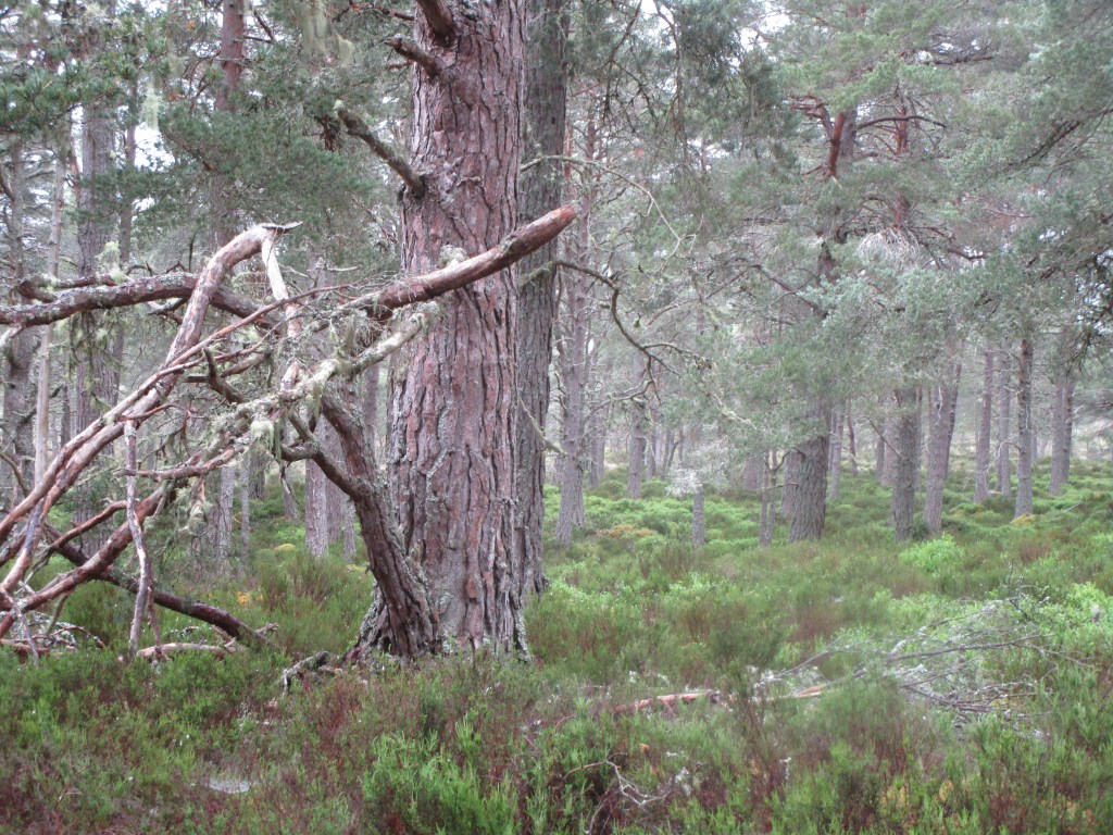
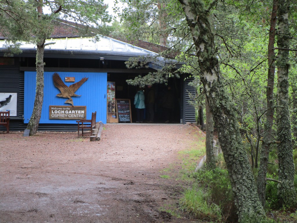
My bogie with the weather on higher level routes continued with that wonderful driving soft rain typical of the highlands today. Luckily I was heading downhill from Tomintoul (I think the highest village in the UK) and across Speyside, where there are plenty of native Scots Pine forests. I called in at Loch Garten RSPB centre partly to try and see a few of the specialist birds of pine and also to shelter from the rain for a while. I managed to see a crested tit, though my efforts to point it out to others failed (also added tree creeper at point blank range, and goldcrest (I cannot hear these when riding, but much easier on foot).
Scots pine forest with a good understorAll forests ought to have lots of dead and decaying woodLoch Garten ospreys are arguably the most famous in the world. The protection on the nest has now been running for 60 years and I know that at least one reader of this blog has taken part in protection (in “earlier” years). It is a little sad that no ospreys are nesting at Loch Garten this year due to the failure of the old female ‘EJ’ to return from migration. The staff were working hard to enthuse visitors about other aspects of the pine forest instead. I know RSPB are trying to diversify away from birds only, but I think they may have lost the plot a bit here – a little fairy home at Loch Garten. Personally I think the organisation needs to focus rather than trying to be all things to all people.
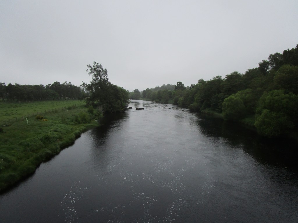
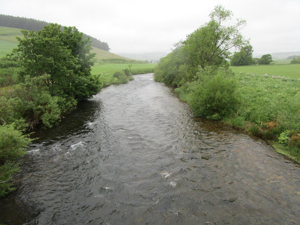
After Loch Garten, it was on through the rain to cross the Spey (a fine river), cross the Slochd pass (405m), pass through the outskirts of Inverness, cross the Kessock Bridge and arrive at my Finlay and Linda’s house on the Black Isle. Both are ex-colleagues from JNCC, and I was sad to find Finlay a little ill, likely having eaten something bad at the weekend. Get well soon Finlay!
The Spey in the rainInverness and the Black Isle are out there somewhere! – view across the edge of Colloden battlefieldThe Kessock bridge – the last big bridge of this trip – separating the Moray Firth from the Beauly Firth. No bottlenose dolphins visible in the Beauly Firth today (should have worked harder in Aberdeen), but I did add common seal to the trip list
Statistics: 90.1 km with 828 m ascent. Running total: 2562 km, 24443 m ascent. 133 bird species.
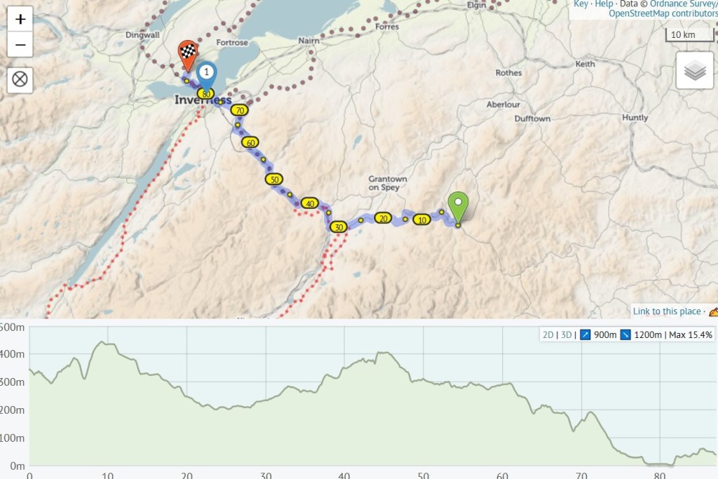
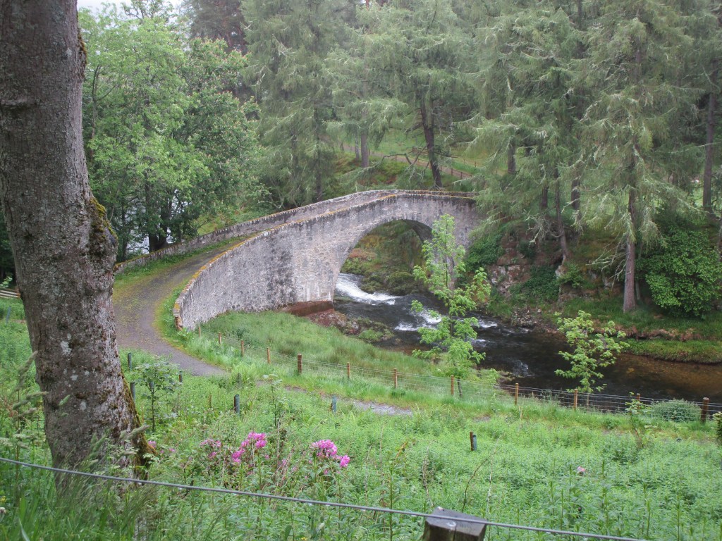
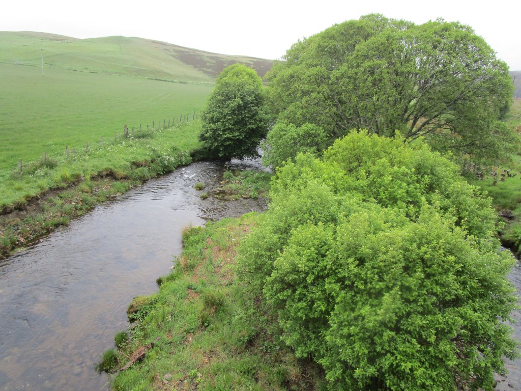
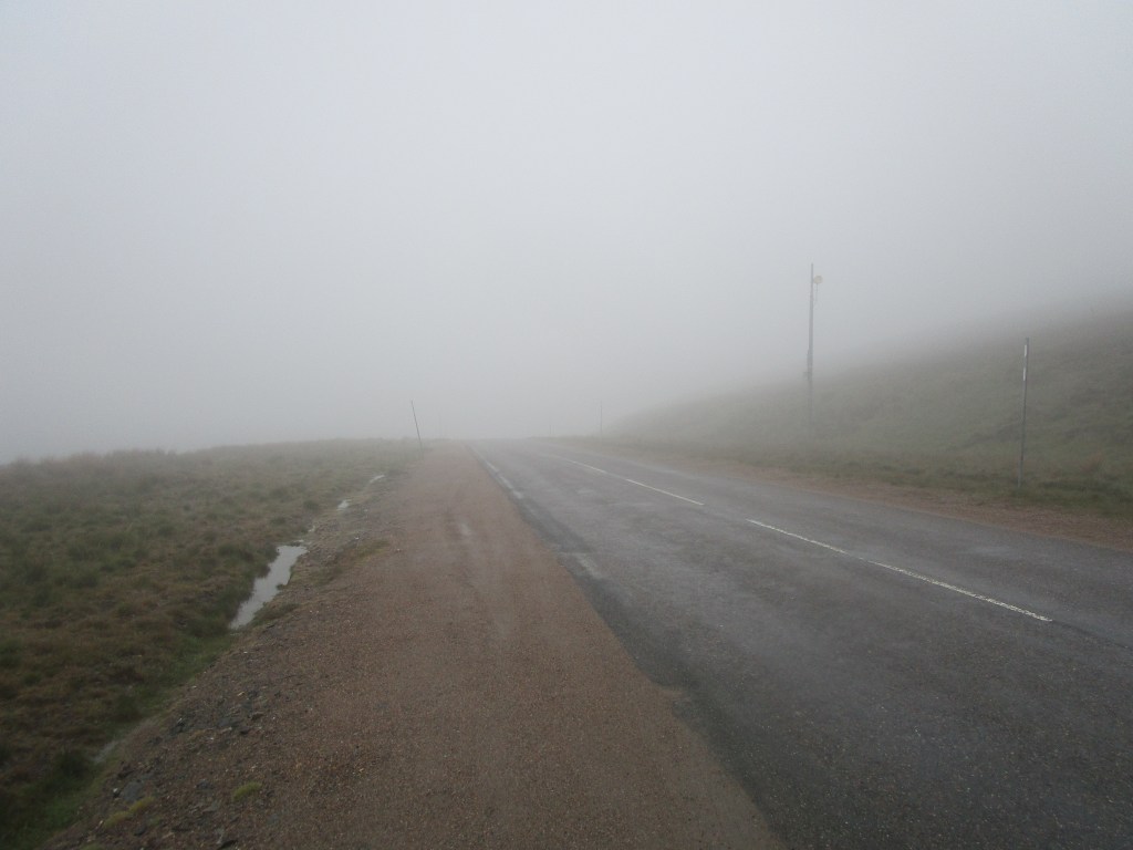
I have now visited all but one of the places that I have lived in the UK, the last is relatively distant on the north end of Orkney mainland and it will take all week to get there. The weather forecast today was dire (including a yellow warning for excessive rain and thunderstorms) so my analysis of the weather charts early this morning indicated that I should set off at around 1030 to minimise risk of hitting torrents of rain. At around 0915, I noticed that it had stopped raining (it was not supposed to do that) and a quick recheck of the weather maps showed the forecast had changed and it would be a good idea to set off immediately. So I did. As it happened, there was light rain/drizzle/mist for much of the way, so I got wet, but no miserably so. The route was over the hills to the Don Valley and then follow the Don until the steep hill over the pass at the Lecht (the highest permanently inhabited building in Britain) and then down to Tomintoul.
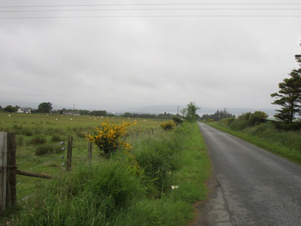
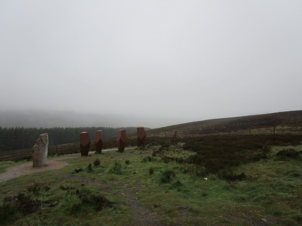
The route today; the section between 35 and 65 km follows the River Don closely, showing its relatively even but rapid descent towards the North Sea. The gradients up to the Lecht from Cockbridge are extreme!My first stop was to add Osprey to my trip list – on a dry clear day you would easily se the osprey on its nest (it is there), but it was neither dry nor clear!A Donside laneFirst crossing of the DonSome bridges across the Don are more picturesque than others – in this case it is at Candacraig, the country house that used to be owned by the great Billy ConnollyLast look at the Don before turning right and heading over the LechtThe views were, err, limited; on a clear day you can see miles from here. It wasn’t.A photo for those whose memory lanes are a bit foggy
I was really hoping to bring you some stunning Scottish scenery pictures today, but no luck. I was also hoping to add mountain hare, red deer and possibly ring ousel to my trip list – no luck either. But the Hotel Square in Tomintoul excelled by noticing me arriving outside and coming out to welcome me and offer me an immediate cup of tea. All hospitality should be like that! I notice also from my window a cycle holiday support bus from a well-known company and I deduce from their website that participants are on a 22 day, 1600 km Lands End to John O’Groats run costing £3,100 (they pay for their own suppers and some lunches in addition), with all their luggage being transported in the bus. A different way from myself, but no doubt they are having fun!
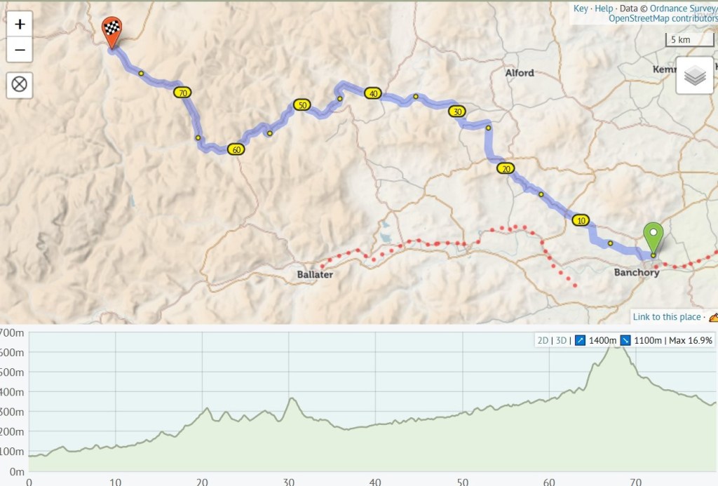
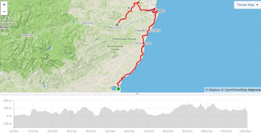
After yesterday’s ride from Montrose to Aberdeen, I came back to our current home near Banchory. Since I have lived here for 32 years (more than half my life), I think this house deserves a post to itself.
Yesterday’s 121 km route (running totals now 2483 km, and 24,443m climbing)
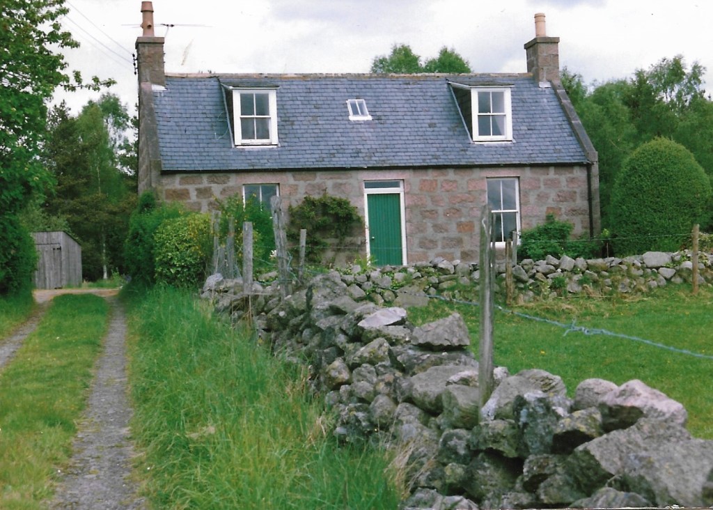
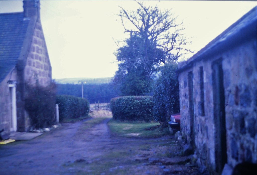
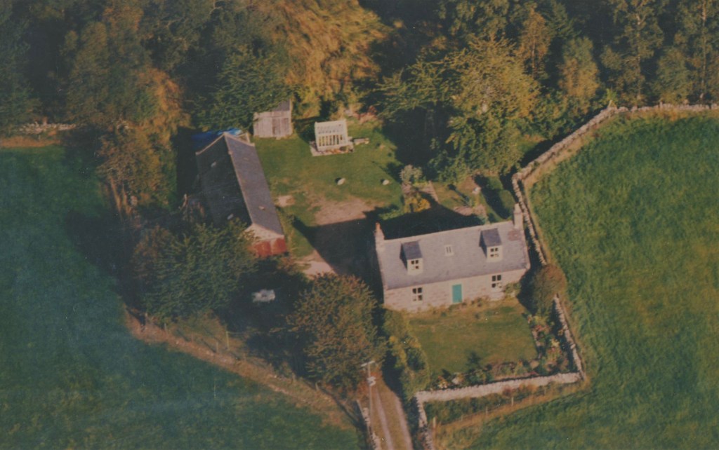
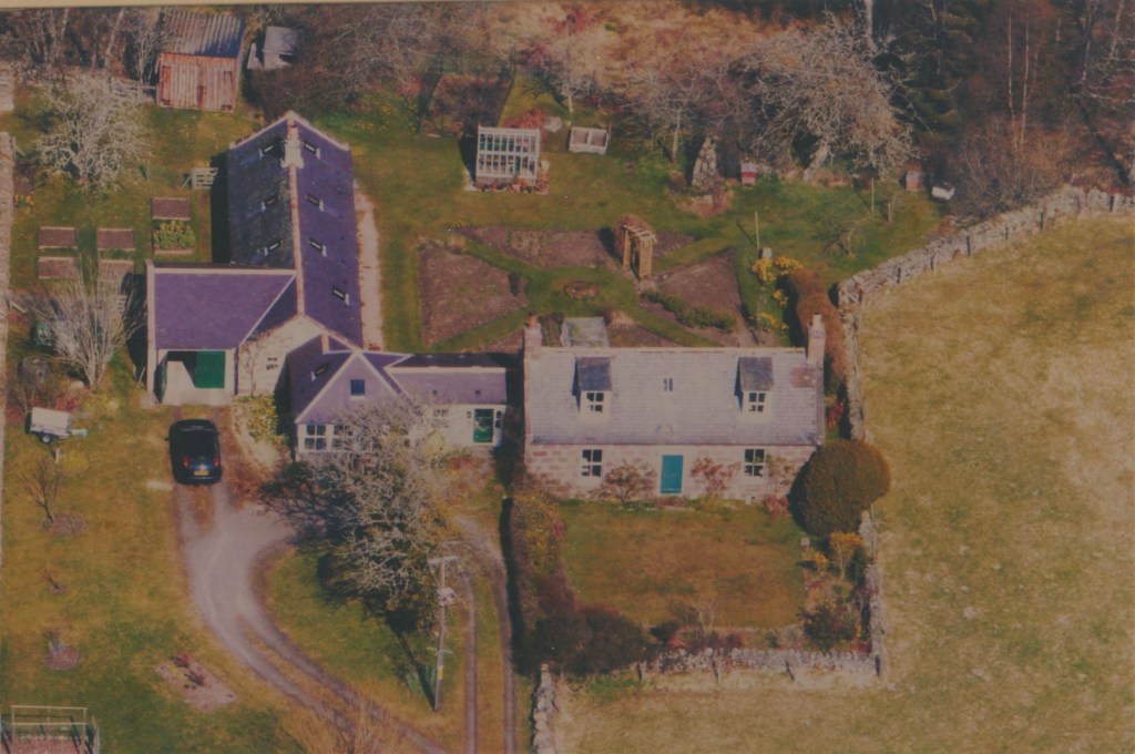
A croft is a small farm, with usually enough land attached to enable a small family to be self-sufficient with a bit of trading. Drumshalloch Croft lies on the Leys Estate associated originally with Crathes Castle and when it was crofted, had around six associated fields. Farming in the 20th century tended towards larger, more efficient farms based on an increasing use of machinery (a trend that continues) and Drumshalloch Croft ceased being a farm in the early 1970s. In 1987, Leys Estate sold the buildings to me. The croft house faces south and its downstairs rooms have high ceilings, with correspondingly low ceilings upstairs. This makes the downstairs rooms very light and was probably the one thing that attracted me most. A set of steadings (outbuildings used for cows and a diary) were also on the plot with a couple of sheds completing the buildings. The croft comes with its own water supply and septic tank.
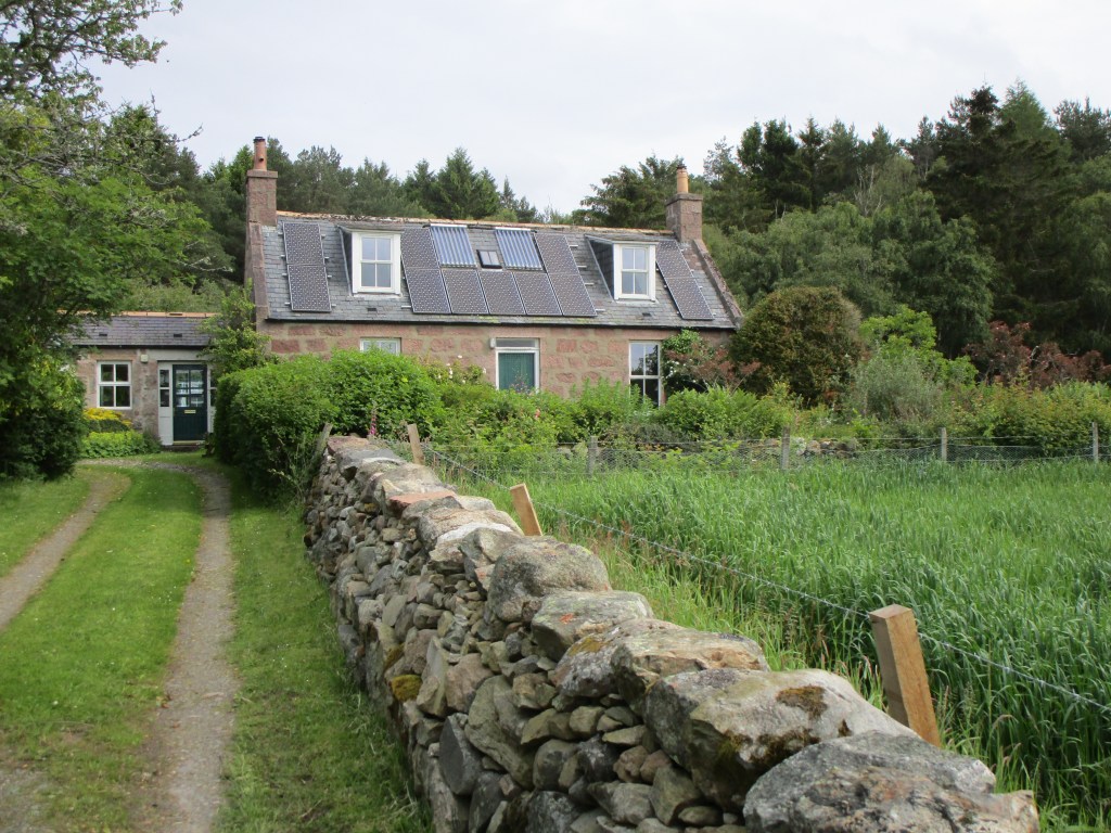
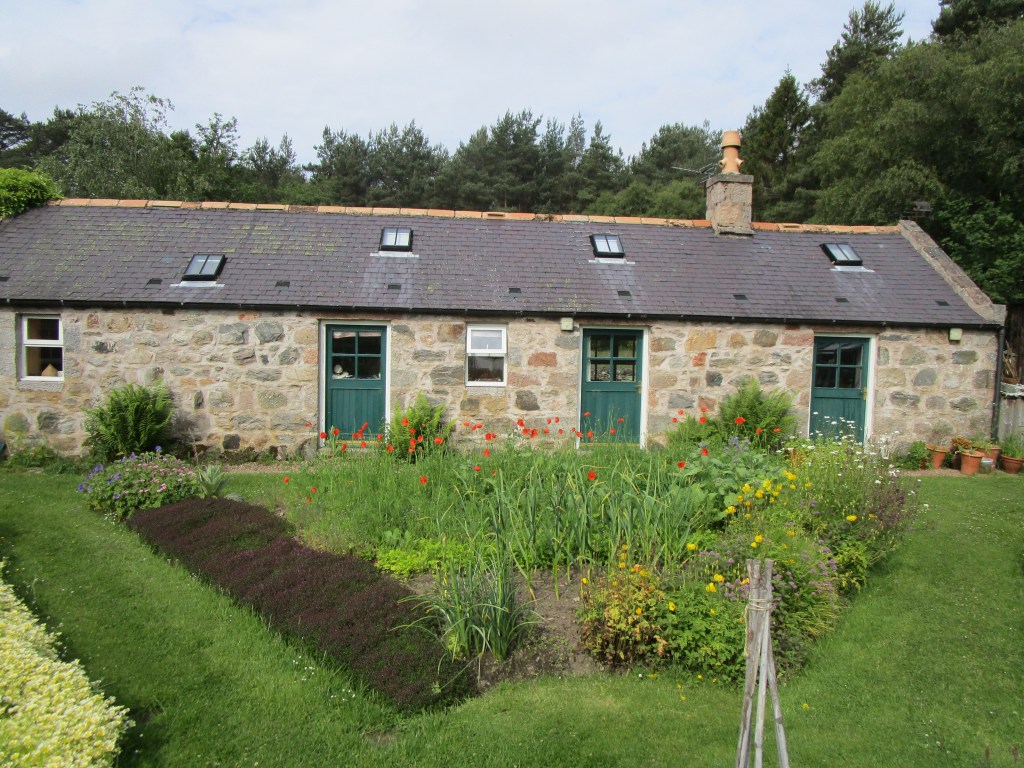
Drumshalloch Croft as purchased in 1987The trees and bushes have grown higher, there are roof-top solar panels and an extension has been built across the drive. The drystone dyke has been rebuilt. Drumshalloch Croft 2019The steadings in 1987, the left hand half of these is the oldest building on the plot, probably dating back about 250 years. The right end was added around a century ago. The steading now forms an extension to the house. The right hand end was added as part of the extension. A chimney was also added. The driveway that was here was dug out entirely by hand and has gone to form the drystone walls around the property (with some left over!). This bed is partly (naturally sown) wildflowers this year. The steading roof contains around 650 soprano pipistrelle bats that emerge each evening from the vent visible in the centre of the roof line.A view down the driveway in 1987, well before the steading was incorporated into the houseDrumshalloch Croft in August 1973. Farming from the croft seems to have stopped by this dateDrumshalloch Croft in 1992, additions include a greenhouse (bought at auction for £20) and drystone walls taking in the house’s sewage system Drumshalloch Croft in 2002 shortly after the extension was finished and the back garden had begun to become established.
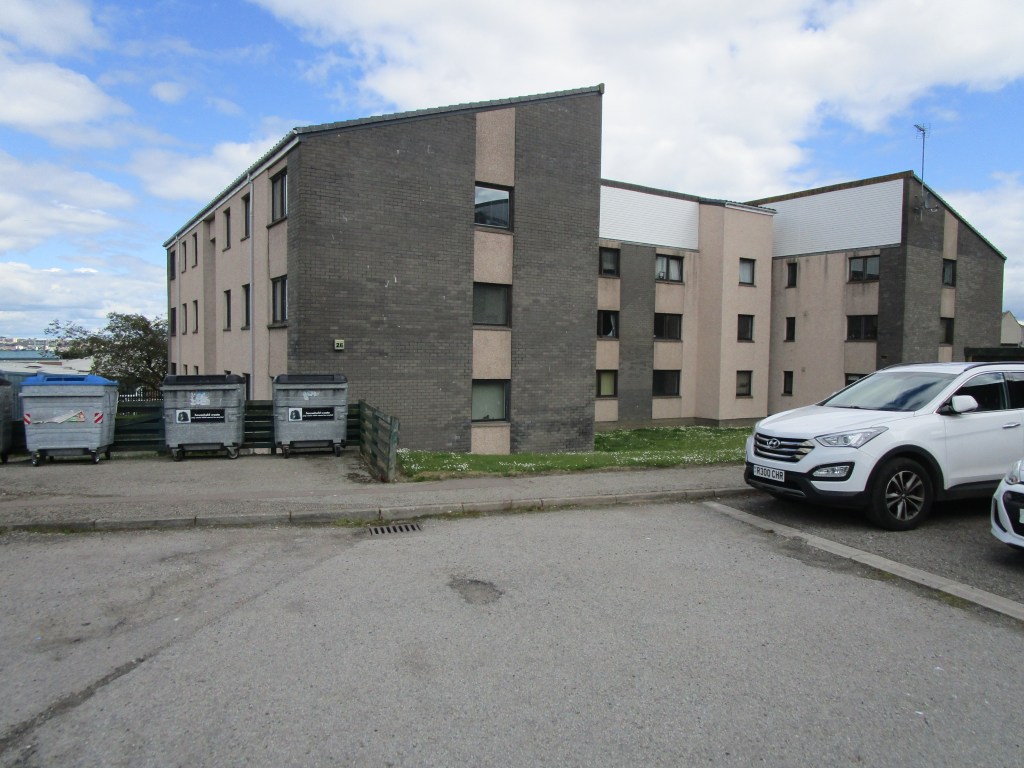
When I moved to Drumshalloch Croft in 1987, Banchory village was about 2 km away and the little valley it is set within was totally dark at night. Banchory has been expanded, basically as a dormitory town for Aberdeen (though the planners claim otherwise) and nearly all the addition has been on “our” side of the village. The dark was lost in the valley about 15 years ago, and within the next two years it is likely that houses will be built up to about 100m from the croft. Sadly I doubt that we will stay much after that occurs – the peace will be gone too.
In Autumn 1979, I moved to Aberdeen to start work on a new project mapping seabirds at sea. Aberdeen was booming due to the North Sea oil industry, and an amazing amount of offshore construction was also occurring. The concern about the effects of offshore oil spills had generated my job. The pedal north from Montrose was fast as it was partly on the main road that bought all the materials and personnel northwards in the 1970s and 1980s, but is now far less used. Aberdeen was also a major fishing port with a daily fish market. There are more or less no fishing vessels working from Aberdeen these days.
Aberdeen had a large fishing fleet in 1980Stonehaven on the way to AberdeenPossibly Stonehaven’s greatest recent export….!
In 1979, our team of four working on seabirds at sea were allocated a basement in the Nature Conservancy Council office. I spent a lot of time at sea, but on land I initially shared a flat in Colville Place with Tim, a friend of mine from Hedon who was studying at Aberdeen University. Shortly after we moved in, I went to a party of one of Tim’s friends at the University and met Anne. A very good introduction, that has lasted!
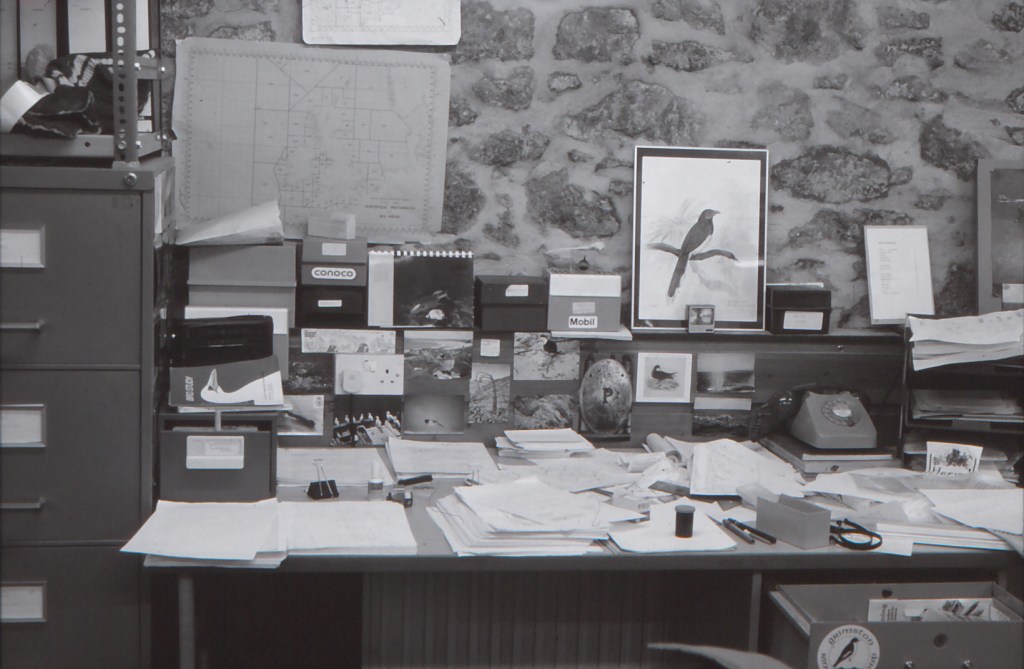
My desk in the Aberdeen basement in the early 1980s. This was a heavy, well-built post war civil service issue desk that survived until we moved to a “standard open plan office in 2012. I liked it! Note lack of computer, the dial-up phone, the card indices, film canister, large amounts of paper etc1 Colville Place in 2019My green Morris 1000 van parked in Colville Place, December 1979Anne, December 1979
In the early 1980s, I moved into Anne’s flat in Nigg Kirk Road. My main memory of that time was trying to produce maps of our seabird observations using Aberdeen University’s mainframe computer. I had written a long Fortran computer program to do this, but it needed all of the resources of Aberdeen University’s computer to run, and thus had to be run at the dead of night. I had to use a dial-up modem with a telephone coupler on a portable terminal that used thermal paper (no screen) lying on Anne’s living room floor. I could not see the results until the next day when I would pedal across to the University computer centre and collect the maps. Of course I made many mistakes, which meant yet more work in the middle of the night.
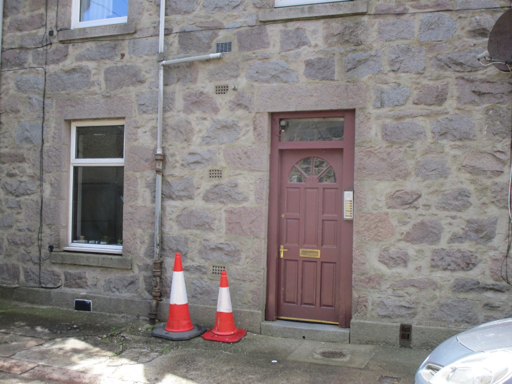
Nigg Kirk Road flats – no change!
After a while, Anne brought a house in Abbey Road, while I moved to a house to the north-west of Aberdeen – Hillhead of Clinterty. This was owned by an Aberdonian Heather, who was an art lecturer in Manchester. John (who I visited in Silverdale) had a link to Manchester and we could rent the house for most of the year, except the summer holidays when Heather would use it. It was a very fine location, but could be very cold.
John outside Hillhead of Clinterty in the early 1980sHillhead of Clinterty through the treesThe view from Hillhead of Clinterty towards Aberdeen Airport and the North SeaHillhead of Clinterty now – the inhabitants did not respond to my letter so I could not get closer/see around, but it has been considerably extended both in front and to the back – the surrounding fields appear to have been taken into its grounds and there was plenty of evidence of horses.Another view of Hillhead of Clinterty now, 100% more tarmac than was there in the 1980s!
In summer time I would either stay with Anne in Abbey Road, Torry or for one year in a flat owned by my friend Hew also in Abbey Road, but for much of the time I was away at sea.
Hew’s flat upstairs in Abbey Road, TorryThe cream coloured, 66 Abbey Road, Torry. This was Anne’s house. While we renovating upstairs, someone broke in (while neither of us was there) and set fire to the house. The fire damage, coupled with that of the water used by the fire brigade to put the fire out, destroyed many of our possessions. The house was rebuilt better than it was before.
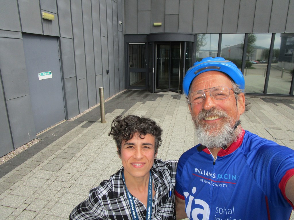
Just around the corner from Abbey Road lies the current JNCC Aberdeen office in Inverdee House. Being the middle of the seabird counting season (and a Friday), only a few staff were in when I called by – luckily one was my friend Sonia. We had a tea and lunch together.
Saying hello to Sonia outside Inverdee House
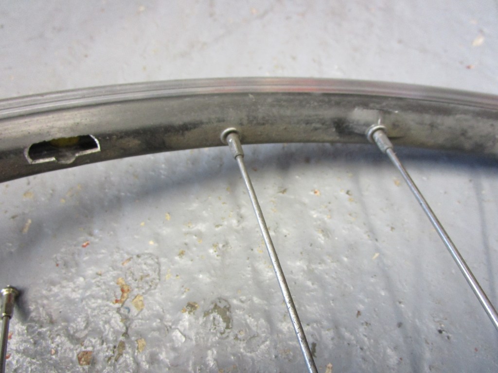
Regrettably I could not stay long because, as I was entering Aberdeen, I had hit a pothole very badly (I could not swerve to avoid it due to traffic). That pothole broke my rear wheel (two spokes pulled right through the rim), and I was keen to try to get it replaced while I was in Aberdeen. After two “we are too busy” phone responses, Holburn Cycles said that they could probably help – and help they did. John, the mechanic there, found a second-hand perfect replacement rear wheel in his workshop and within 20 minutes of arrival I was back on my way again. Exemplary service once again from the cycle shops of Britain. Holburn Cycles are going to get more trade from me!
Detail of a wrecked rear wheel before it went in the bin
A travel day with strong wind (mostly) pushing me along started in Anstruther where I had stayed with my JNCC friend and colleague Kelly, along with her family.
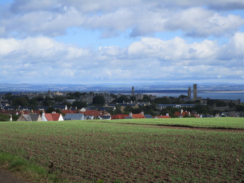
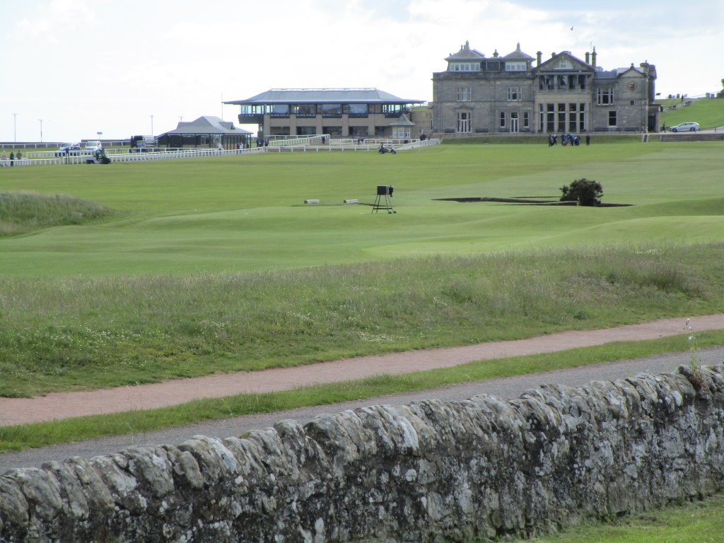
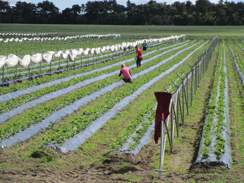
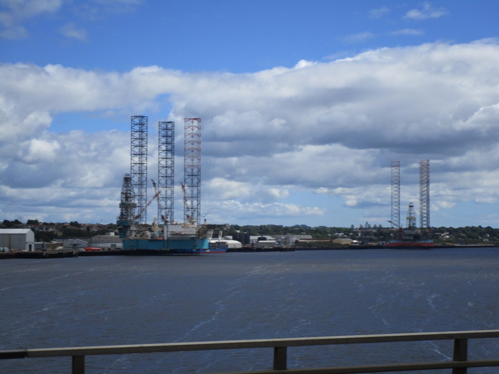
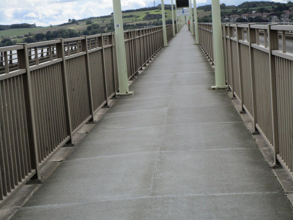
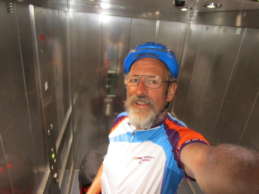
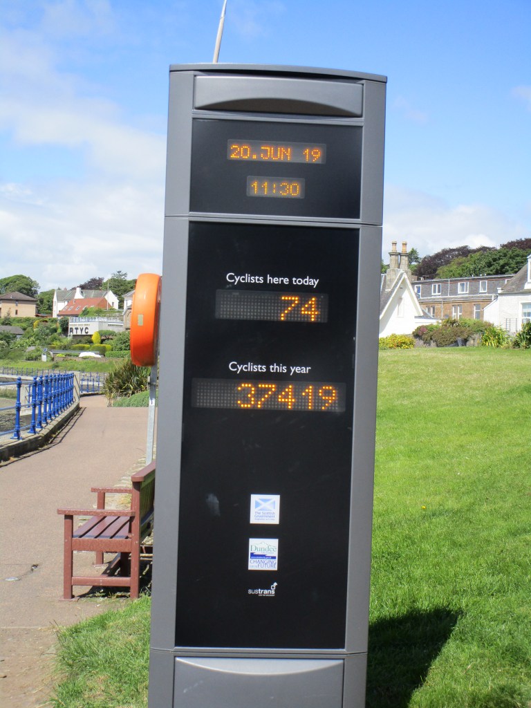
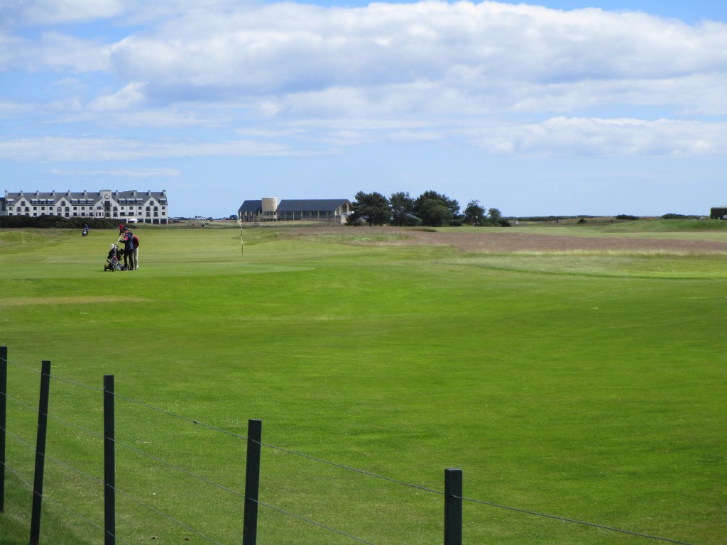
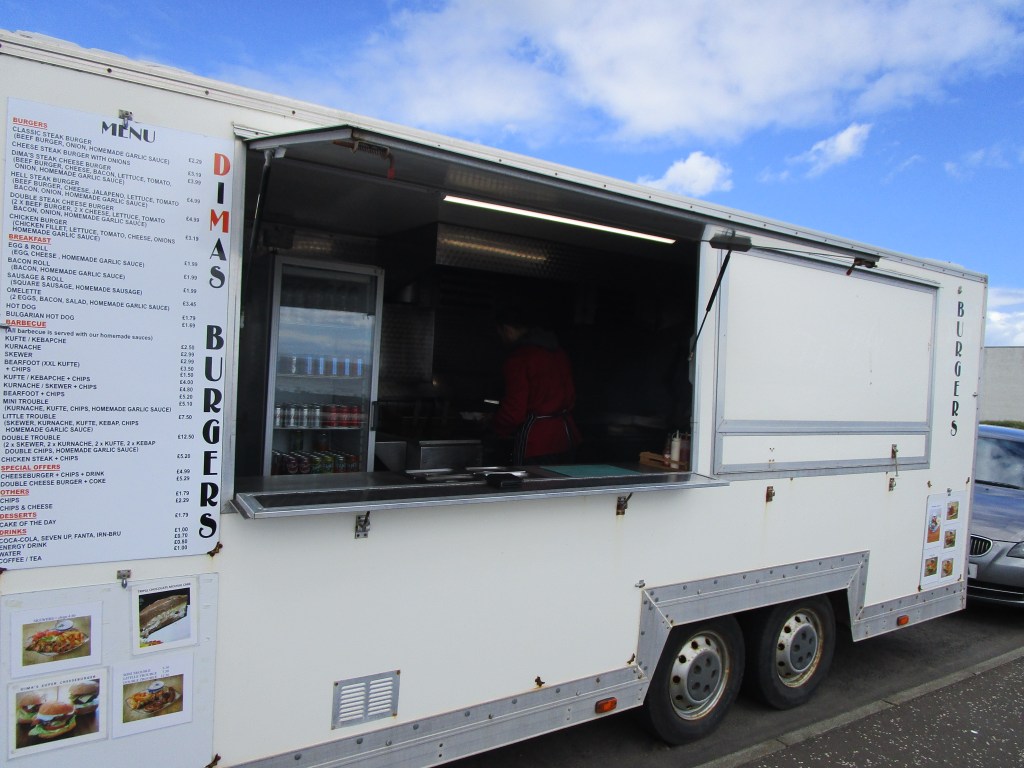
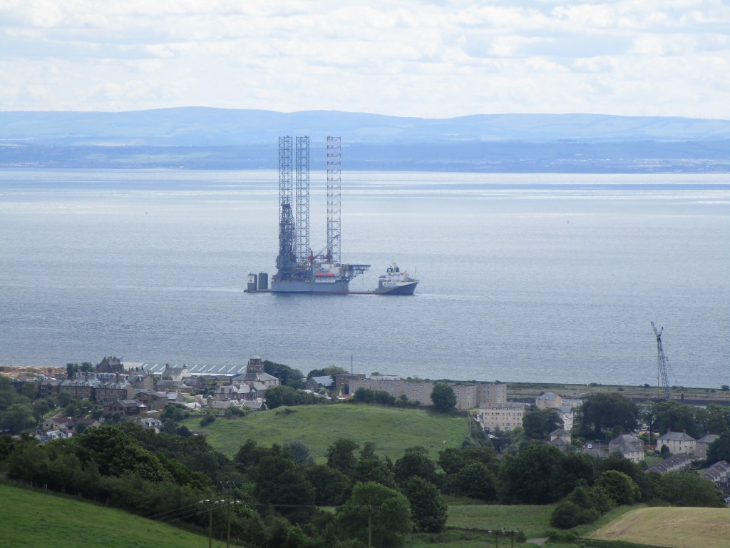
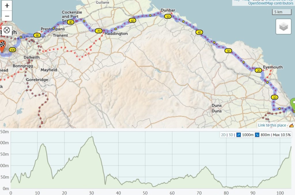
Al, Kelly and Ethan (Millie had not appeared yet!)Today’s routeFife has many large arable fieldsClear air today – St Andrew’s in the foreground , Tayside and Angus in the background, and Banchory (home) lies over the hills furthest in the distanceSt Andrew’s is famous for its golf courses (and university)There is a lot of soft fruit grown in Fife and Angus – at one point I spent about 2 km passing strawberry polytunnels. These Polish workers were working on the strawberry plants for next year I think.Raspberry and currant polytunnelsThe Tay is being used as a jack-up rig parking place just now – another one was on its way (the same one as I saw off Kinghorn in the Forth) as I cycled out on the north side of the Tay.The Tay road bridge’s bicycle and pedestrian pathway runs between the two carriageways. As with the Forth road bridge this was a very windy crossing and I took it slowlyI do not think there are many of these in Britain – a lift dedicated for cycles from the central trackway of the Tay road bridge down to ground level on the Dundee side. I could roll straight inDundee takes the “good cycle infrastructure” top award so far, based purely on my experience of course! Very pleasant cycle paths, a cycle lift and a focus on statistics too. Well done all involvedI stopped to watch two golfers at Carnoustie – there being dire warning signs about dangers on the cycle path from errant golf balls. The first player took two practice swings, shuffled up to the orange ball, swung and it went all of 10 m along the ground. The second repeated the two practice swings, stepped up and firmly hit the ball into the air, unfortunately at about 90 degrees to where it was meant to go. It shot across the bicycle track at cyclist head height, ricocheted off the railway fence back across the same path at the same height and landed not far from the first player’s ball. Those warning signs are valid! I have been varying my food sources on this trip. Usually I like to stop and take a seat for a break at lunchtime but today having failed to find anything else, I stopped at Dimas Burgers truck parked on a side road in south Arbroath. Dimas turned out to be a young Bulgarian who has lived in Arbroath for the last ten years, but only got his truck last year just before the hot summer. He did well then, but has been struggling a little with this year’s weather so I was pleased to give him a little custom and company. Like many, he was concerned about UK’s current direction in relation to Europe. For the record, I had his “little trouble” platter. There is a lot of crustacean pot fishing based from Arbroath
I have been very poor at keeping you updated on statistics. The most important is that the fund-raising passed £7000 today. I am not sure that I will achieve my £8000 target though, so have been pondering other fund-raising ideas. How would a sponsored vote on whether my beard and moustache stays or goes be received? could I sell enough calendars of bathtubs in fields to make producing them worthwhile? All thoughts on these ideas or any others would be welcome.
Other statistics: total distance so far: 2353 km (=1462 miles), 23128 m ascent, 116 new bathtubs in fields sighted, bird list at 117, live mammal list at 19 with a further 4 as squished vehicle victims.
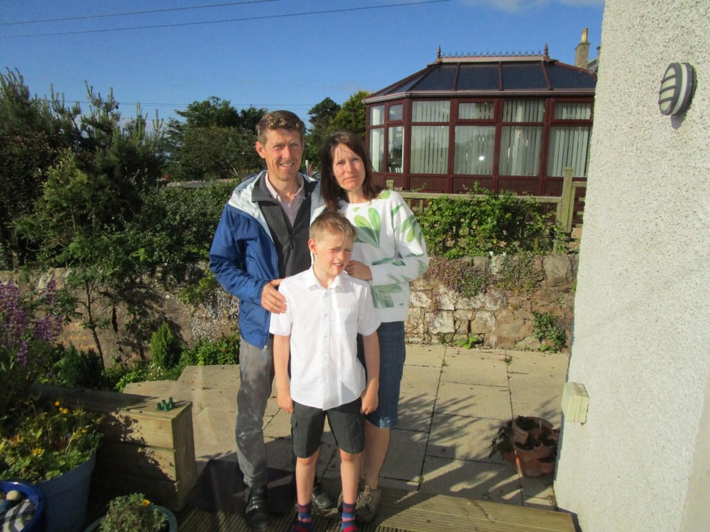
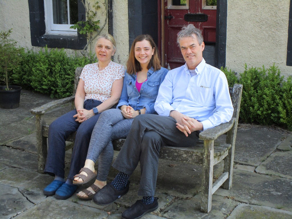
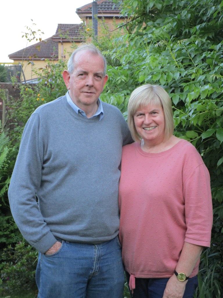
I set off today from my friends Simon and Jo’s house (here pictured with Nathalie). I have been friends with Simon since the 1990s. Simon and his team work on cetacean bycatch and we have very similar attitudes to such issues. We only discovered a couple of years ago that we had both been to Marlborough and overlapped by a year. It was very good to see them as Simon has just finished successful radio and chemo treatment for throat cancer and although feeling tired is on the road to full recovery
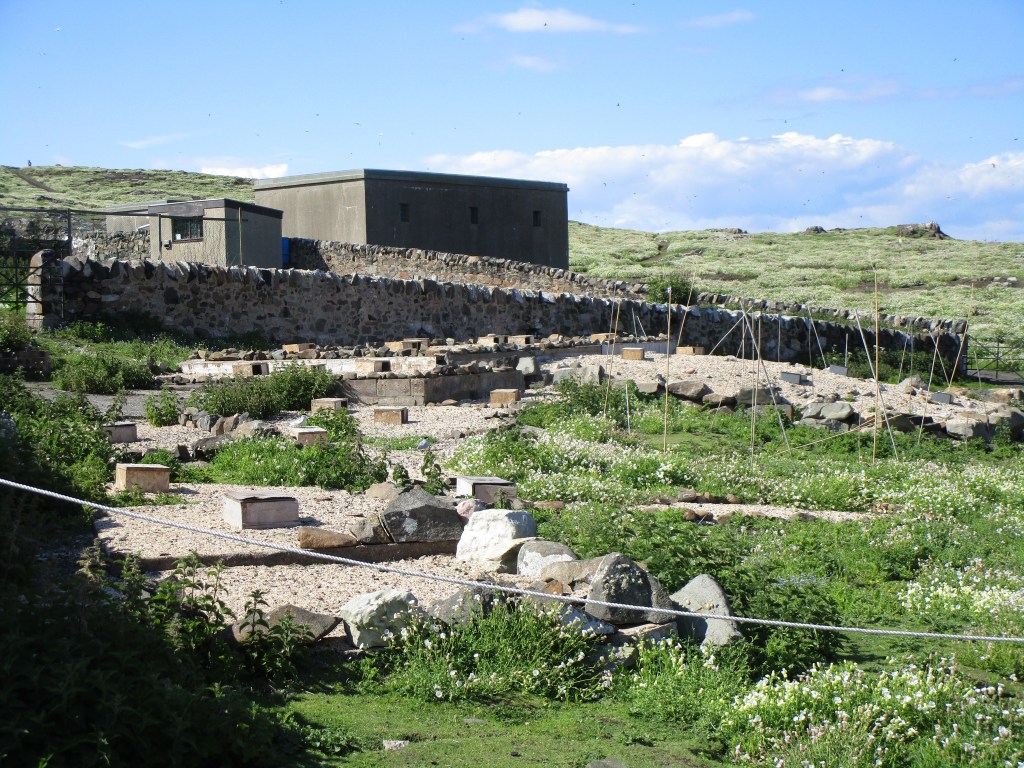
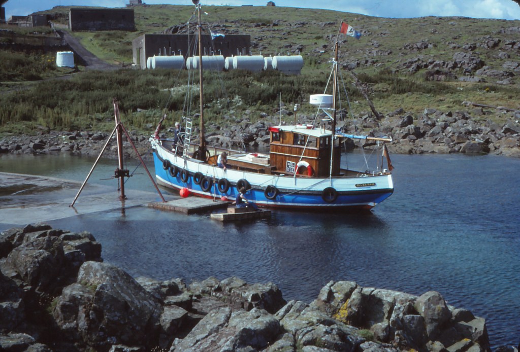
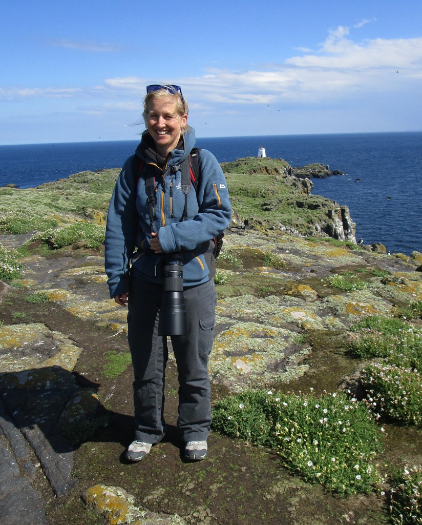
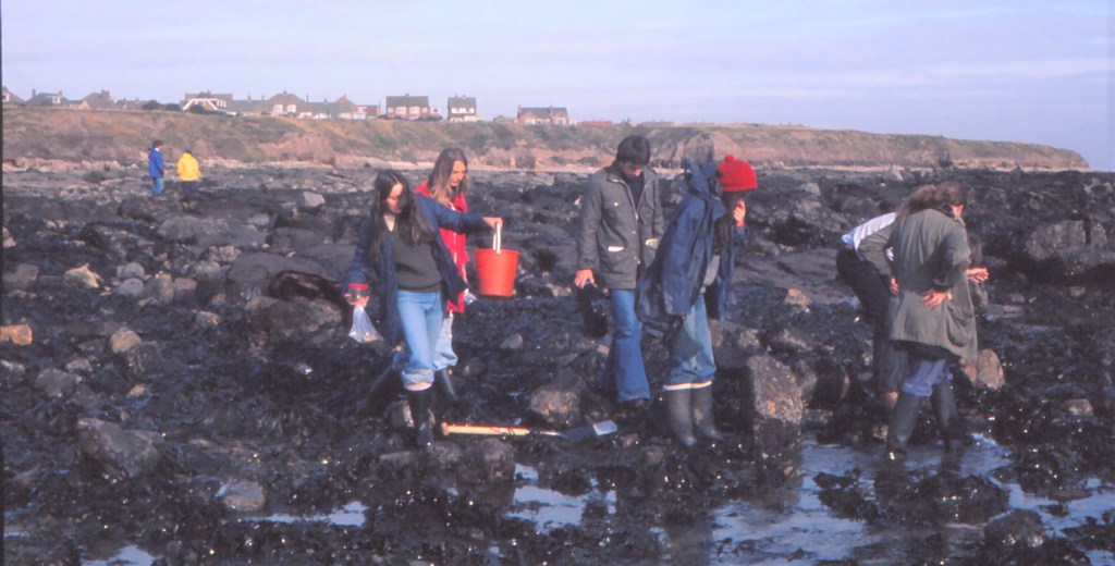
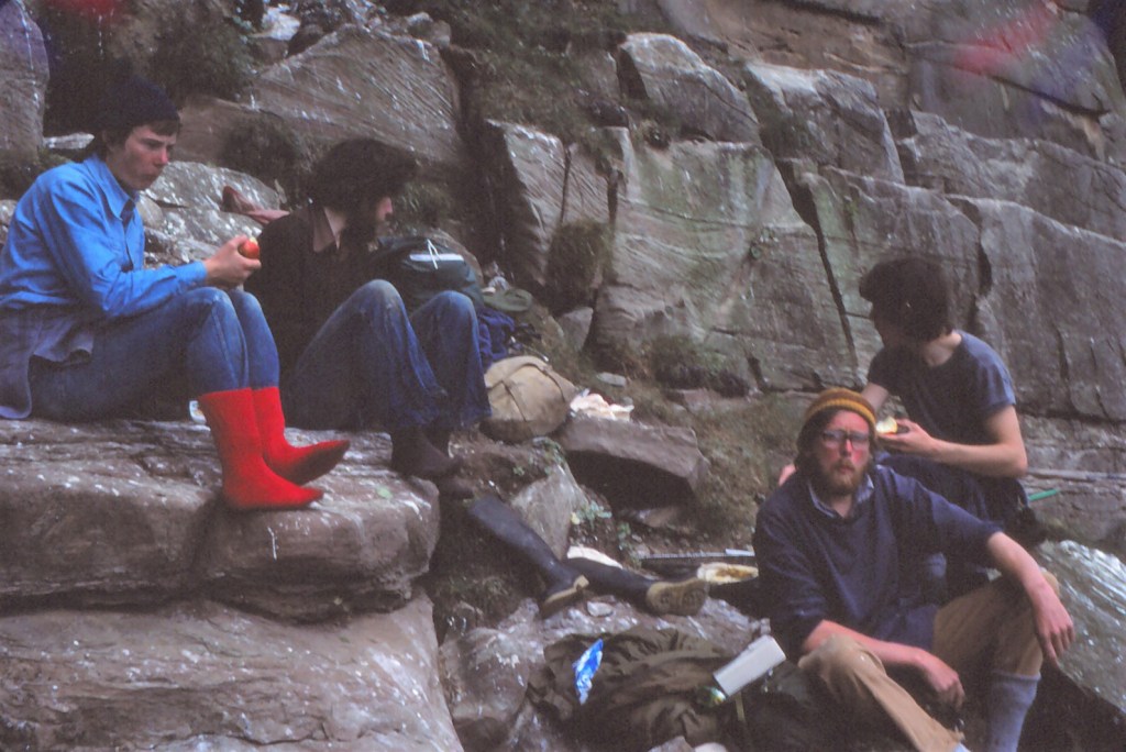
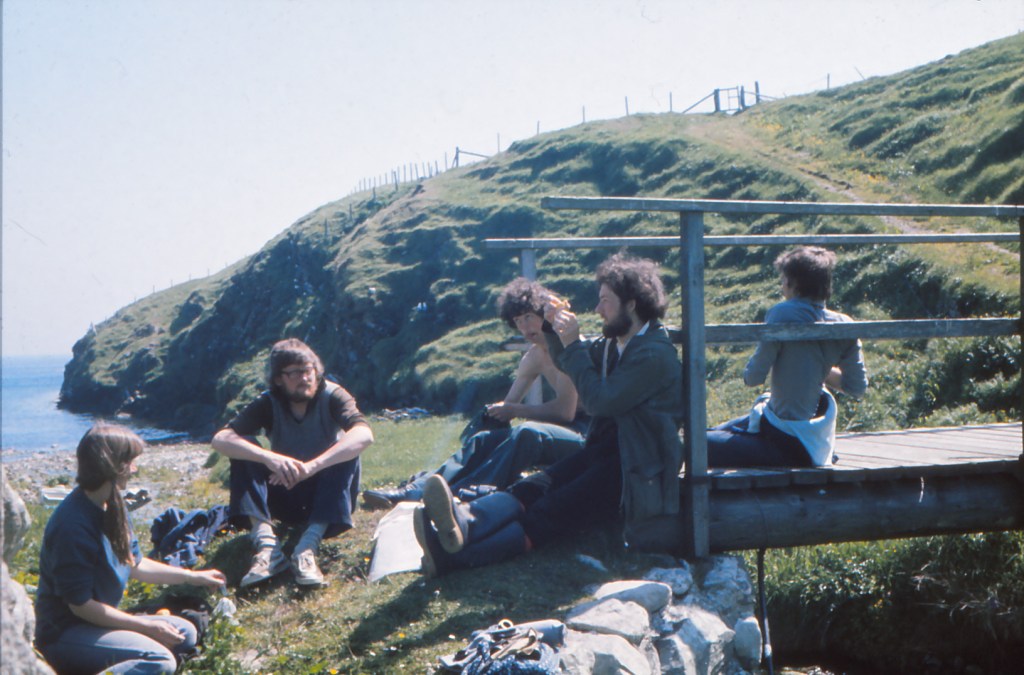
I had been looking forward to today for much of my trip – the Isle of May is a superb seabird colony in the entrance to the Firth of Forth and I had the privilege of being warden there in summer 1979 – just a mere 40 years ago! My main role was to greet visitors to the island and guide them in what to do, and what not to do. I also supported the research being carried out on the seabirds and generally make sure the National Nature Reserve was well looked after. There was a large gull colony that covered most of the island and important numbers of cliff nesting birds and puffins. I cannot remember how many visitors came, but I do not think it was much more than 1000 (I did count, and somewhere at home I will have the report). We (myself and whichever researchers were about) lived in a small research hut called the Mouse House after the project on mice that had allowed the hut to be built. There were three lighthouse keepers manning the island and occupying both the lighthouse itself and other accommodation. A bird observatory occupied a disused lighthouse building and was home to around 4-6 birders/ringers who changed over on an approximately weekly basis. Travel to the island was on shellfish creel boats, one in particular run from Crail by Jimmy Smith.
The Mouse House – could sleep up to around 6 researchers at a pushThe Mouse House has been removed and its base covered in gravel and shelters for tern chicks 9the bamboos are to deter gulls from swooping to take the chicks alsoDesirable tern residenceA pair of Arctic terns at their residence – I was attacked shortly afterwards by the male (on the right). All visitors to the island have to pass through a mob of angry terns at the moment
Travel nowadays to the island is on a boat carrying around 100 people that goes nearly every day of the week for a 5 month season. Last year there were around 13,500 visitors to the island.
The Hilda Rose at the Isle of May in 1979 (at a high spring tide too). The oil tanks in the background (used to supply the lighthouse generators) are gone and have been replaced by a visitor centre with a vegetated roof and nesting terns.
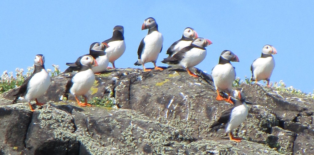
The main attraction of the island is undoubtedly the puffins. More than 40,000 pairs nest on the island. Visitors are guided to stay on well marked paths in order to avoid collapsing the puffin burrows that are more or less everywhere where the soil is suitable. These paths were all there in 1979, but the sign-posting and roping was not.
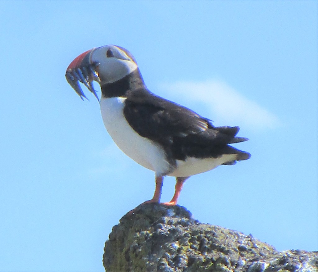
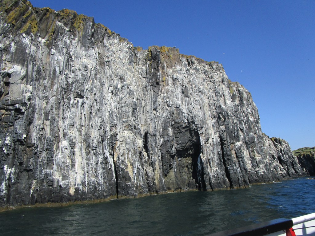
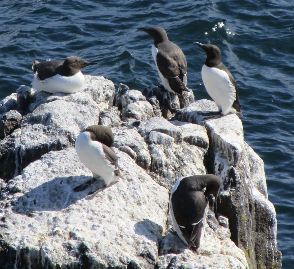
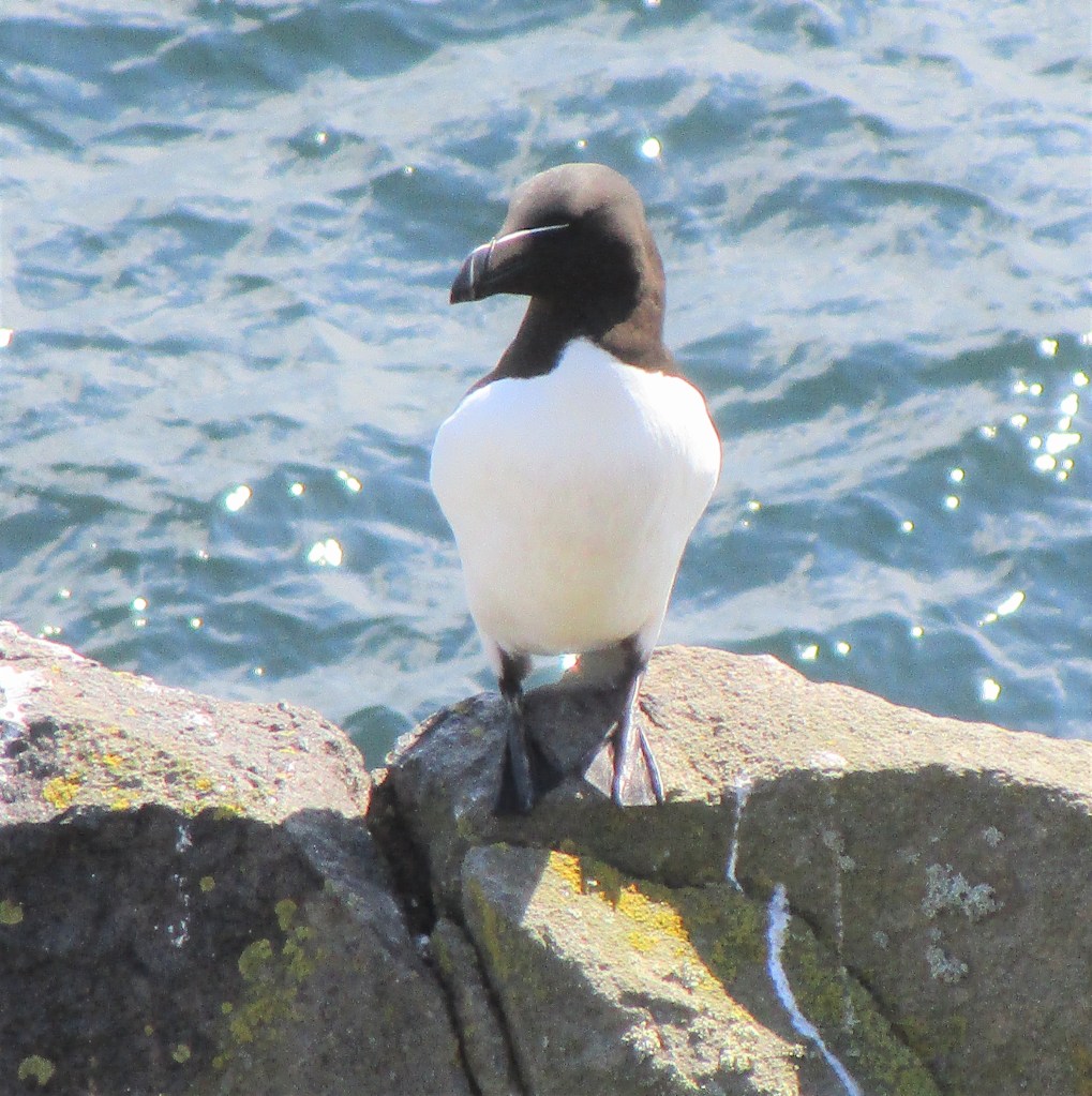
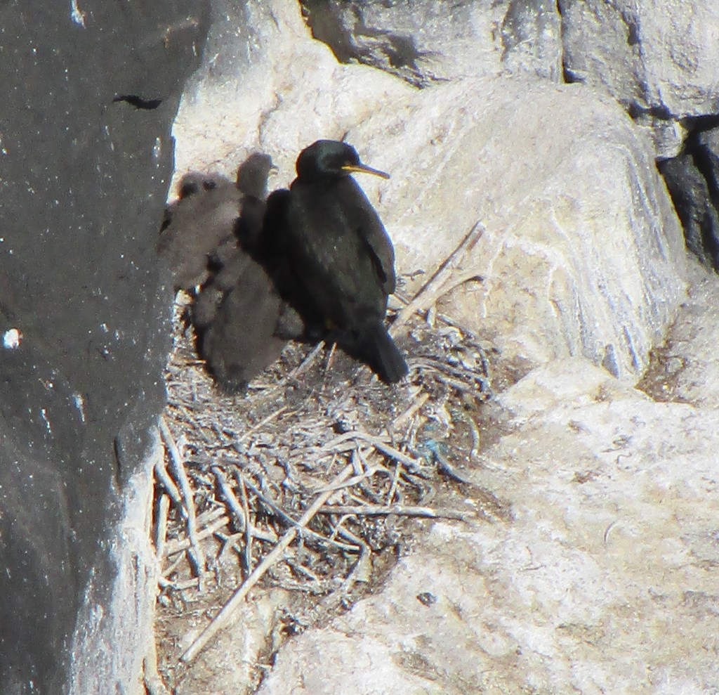
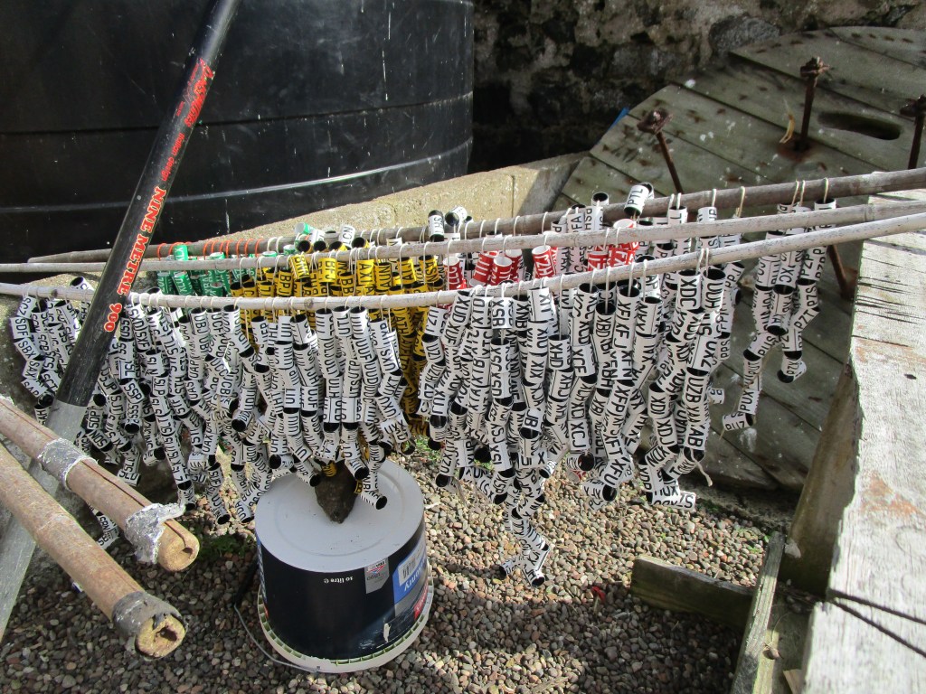
Atlantic puffinProbably the most photographed puffin on the island yesterday – a group of around 15 Japanese photographers were all around this bird with some very large lenses – undoubtedly their pictures will have been better than my little point and shoot cameraThe Isle of May’s west cliffs have very large colonies of guillemots, razorbills and kittiwakesCommon GuillemotsRazorbillShags on the Isle of may are scattered around in caves and lower cliffsRings for shags
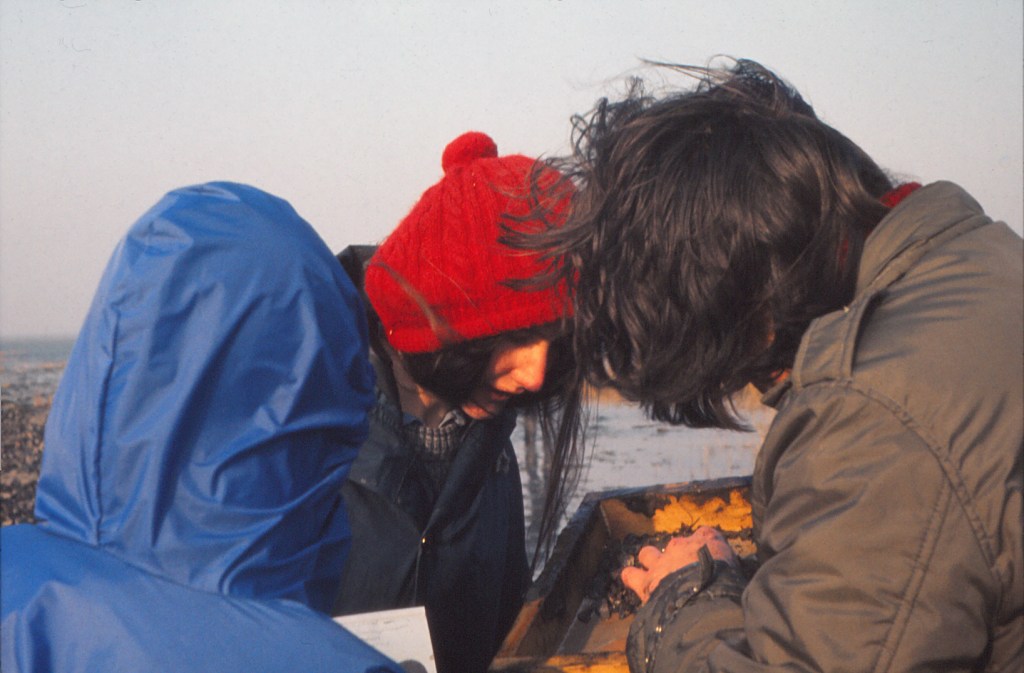
The number of researchers on the island has risen to around 14 now – sadly my friend Mike who was I think instrumental in getting me the job as warden in 1979 was coming onto the island a day after my visit, so I did not see him, but I did get a cup of tea with some of the research team. He has maintained studies there since 1973, an extraordinary record. At present the main focal species appears to be the shag (a type of cormorant) and most of the population is marked with uniquely lettered colour rings. These can be read with a telescope in all seasons and thus the detailed life histories of some birds can be followed.
Yesterday was also another day for co-incidences. In 2016, late in my time with JNCC, I took part in a six week research trip counting whales and dolphins in the Atlantic off Scotland, Ireland and France. The poor sea-handling and lack of mirrors on the ship caused me to grow my beard. On that ship we worked in groups of two, and my co-researcher was Becci. I was thus amazed to see Becci step on board the boat to the Isle of May as we were boarding in Anstruther. We did a lot of catching up on the way out and it turns out that she is planning a long bike ride herself, following the grey whale migration southwards off western North America to Mexico this coming autumn (thegraywhalecycle.com). That is a truly impressive trip (and makes me rather envious!). Good luck Becci!
Becci
In 1979, one of the island’s visitors was a young artist called Keith Brockie. He later produced a beautiful book: One Man’s Island of paintings done on the Isle of May. One of my memories was of drinking rather too much of my home-brewed beer in one session with him (turns out no-one is producing home-brew on the island just now – surely a gap?). Anyway, I was delighted to here that by yet another co-incidence he was on the island and I tracked him down to find him sketching a razorbill and its chick – not much change there – but then why change something so good already?
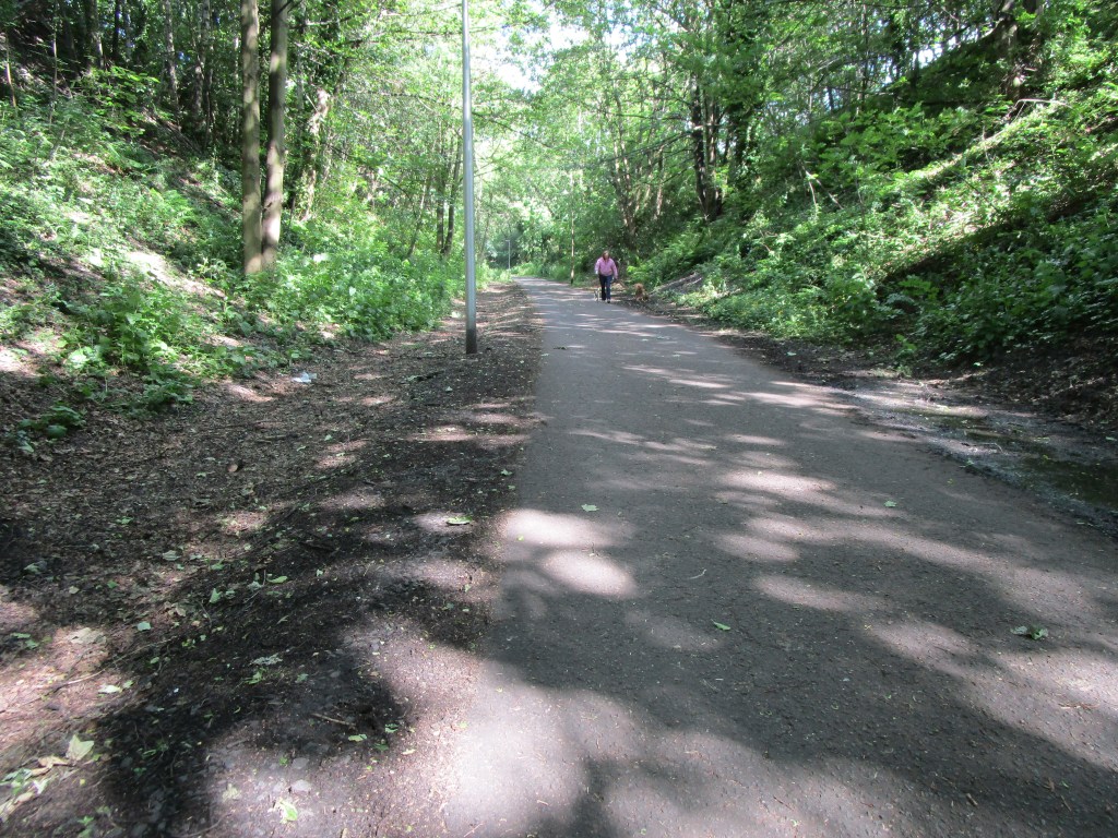
Scotland is not a huge country, but every time I cross the Forth road bridge I am reminded of my friend who, several years ago, called me after crossing the bridge to say that they would be with me very shortly, not quite realising that it was another 2.5 hours to Banchory. I had a few problems getting out of Edinburgh due to my navigation system not liking the incredibly poor road surfaces (or at least that is one possible reason!). Once onto the old railway lines to the NW of the city the surfaces were much better (it is SO sad that the lines of the old railways were sold off so readily in most areas – what an asset they are now)
Another fabulous ex-railway bike (and pedestrian) track in the heart of a city
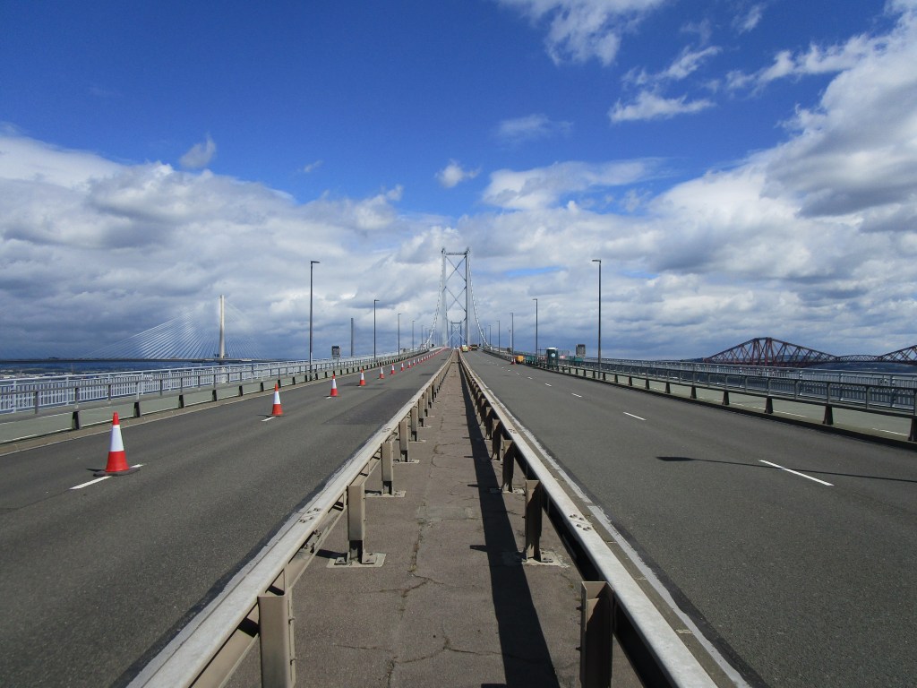
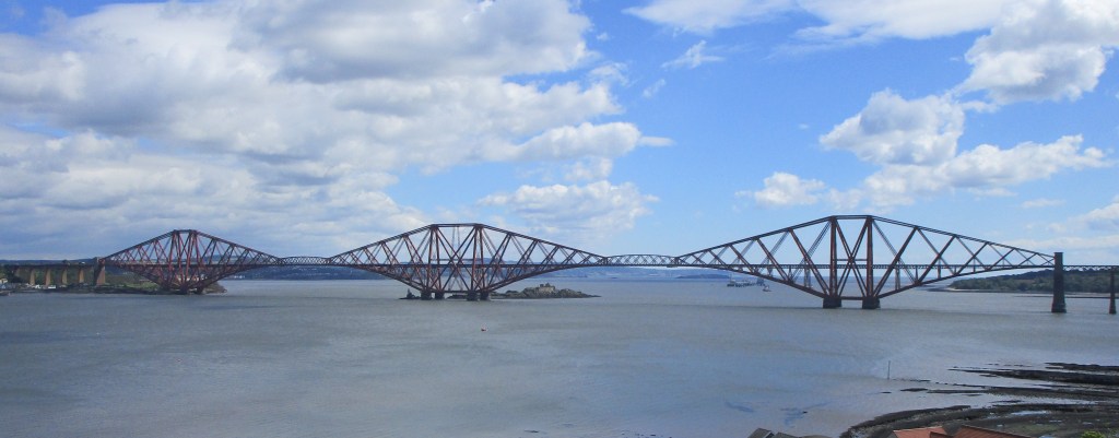
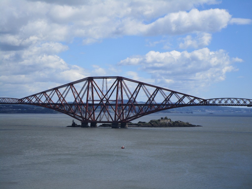
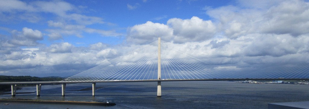
The Forth is now crossed at Queensferry by three bridges, from three different centuries. The rail bridge is iconic, being seriously over-engineered for its purpose (following the under-engineered Tay rail bridge disaster); the road bridge is a suspension bridge built in the 1960s that was over-used and had started to show signs of wear, while the newest Queensferry crossing is a cable-stayed bridge that opened a couple of years ago.
The bridges viewed from a distance. Rail bridge = red, Queensferry crossing is most obvious in white, the road bridge is less visible between them
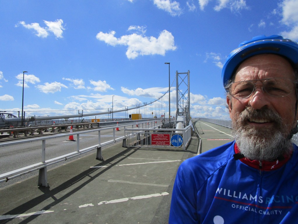
Nowadays the road bridge is primarily for busses, bikes and pedestrians, though I did see a few cars driving across it too. It is being maintained, so I guess that it could be used in emergency also.
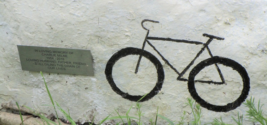
The traffic on the road bridge is minimal, so it was possible to park the bike and take a stroll across the carriageways by climbing the various barriers (well, nobody stopped me!)A good view of the rail bridgeTerrific Victorian engineeringThe Queensferry Crossing is equally beautiful to me, but difficult to photograph with clouds in the backgroundThe winds yesterday were pretty strong and gusty so even though the cycle carriageway is wide, I rode gingerly across the Forth. This is me looking relieved to be on the Fife side.A jack-up rig on a transport vesselView across the Forth to EdinburghThe outer Forth from Kirkcaldy with parked oil drilling rigs in the distanceYet further great ex-railway cycle infrastructureI was rather taken with this discrete memorial to a cyclist at a very fine viewpoint on a little-used back road in the hills of Fife. For those reading this on a small device, the inscription says “In loving memory of Charlie Milne 1954-2018. Loving husband, father, friend, still oiling the chain of our lives”
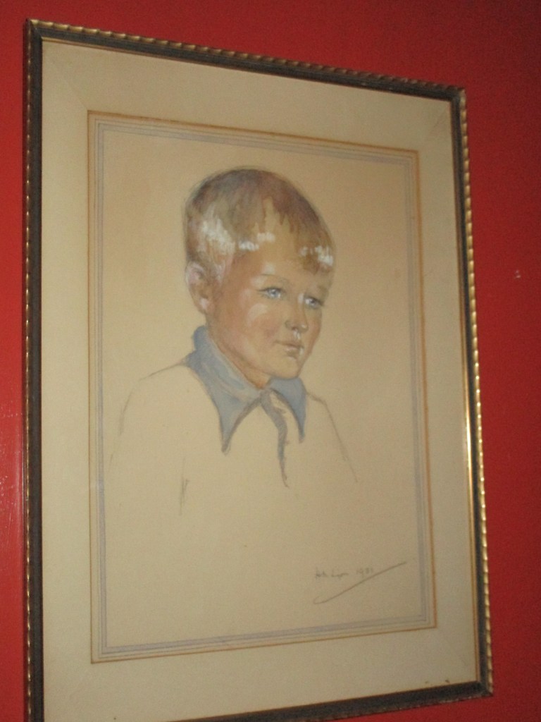
Dad
It was Father’s Day on Sunday and of course I thought of my father then. More significantly though yesterday (18 June) was his birthday, and I always think more about him on that day. He would have been 94.
Dad, in sun-glasses, on Frencham pond, early 1930sPortrait of Dad, also early 1930sDad with his mother on her 80th birthday
I think this is the only picture of Dad in the brief phase that he had a beard and long hair in the 1970s
Dad with his family in the 1930s, I think I know who I inherited my dress sense from
Here’s to all Dads and their good influences on our lives.
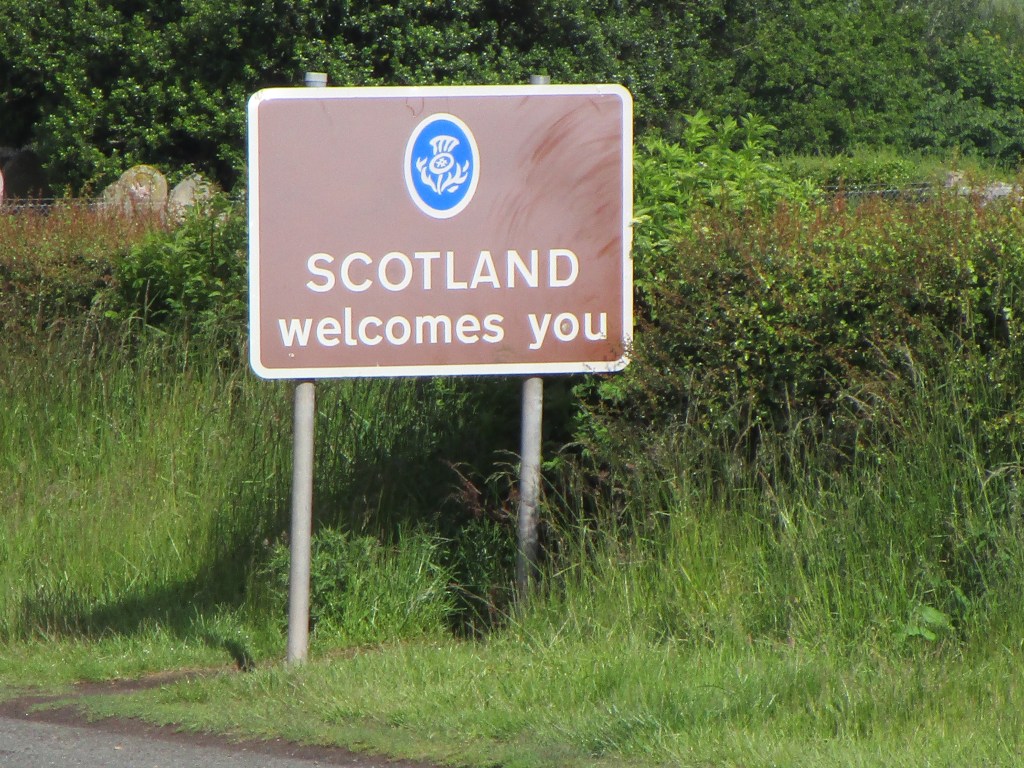
After 2000 km and 3.5 weeks of pedalling, I finally made it to Scotland today. I have lived in Scotland for over 40 years, so it was good to be home.
2000 km of cycling in England, some bits harder than others
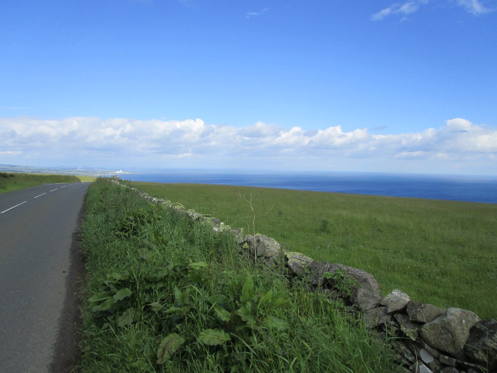
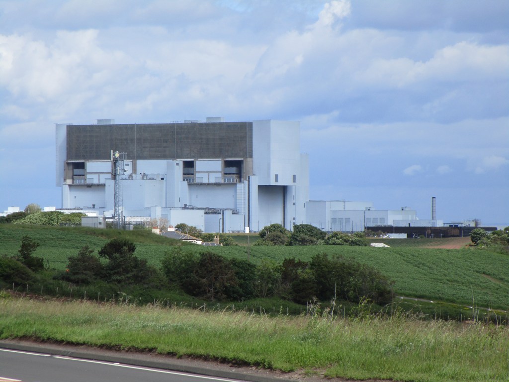
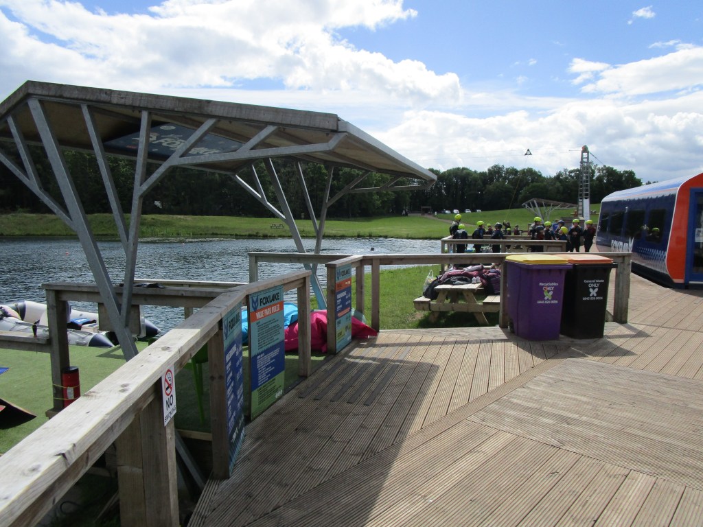
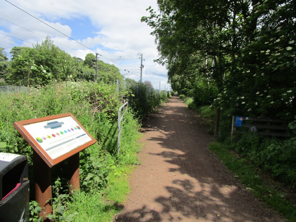
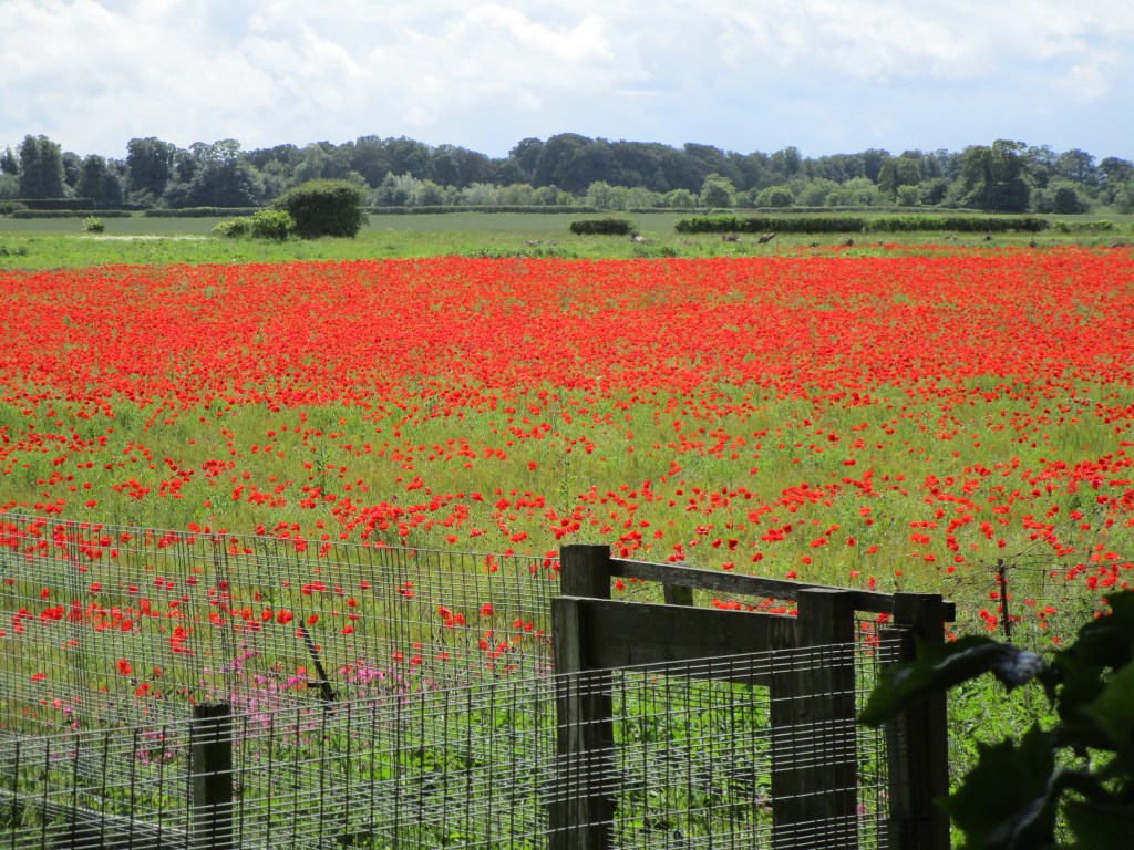
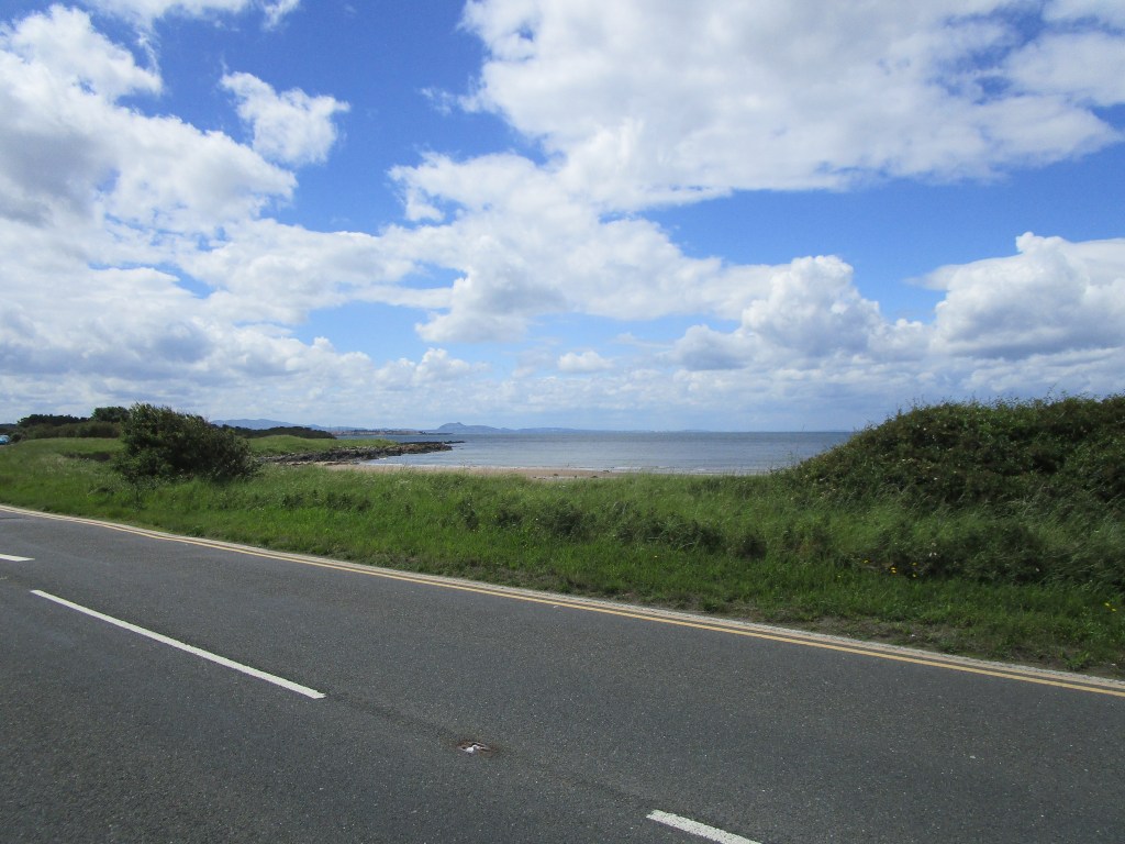
The hills on the borders meant a little climbing, but otherwise fairly level. There was though a strong westerly wind which made for harder workThe end of the second climb gave magnificent views over the entrance to the Firth of Forth, including a distant Isle of May (my next ‘lived there’ destination), Bass Rock and Torness nuclear power station (the white dot visible beyond the end of the wall)Torness power station’s colour is designed to ‘hide’ it from closer to, but makes it much more obvious when seen from above and farI stopped for a break at a small recreational facility called Fox Lake – kids in full safety gear being allowed to play on zip wires and on other water-based fun activities. We did not get this when we were at school, but of course we did these things informally. The kids were enjoying themselves – I enjoyed my coffee and cakes!An old bit of railway line has been turned into a fabulous cycleway to the west of Haddington, without too many dog walkers with out-of-control dogs Best poppy field yet!The view westwards from Longniddry up the Firth of Forth with Arthur’s Seat in the distanceThere are still fishing harbours on the Forth – CockenzieOvernight with Colin and Maria. I have known Colin for as long as I have lived in Scotland, with several good parties at his house when he was doing his PhD. He later joined the Nature Conservancy Council and lived near Peterborough with Maria, often providing a bed for me when I visited. It is always good to see friends and to catch up.
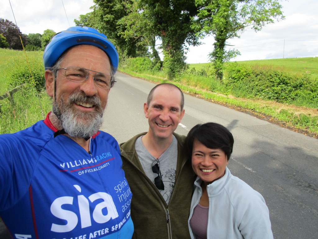
I am writing this about 4 km from Scotland – so today was the last in England, in its far north-east. The day started off though with one of those co-incidences that make life fun. I had noticed that my friend Rob Hutchinson who usually is leading bird tours in the far East for his company, Birdtour Asia was on holiday in coastal Northumberland; we suggested having fish and chips in Seahouses today, but Rob and his family had decided to visit Alnwick today (where I stayed last night). So we agreed to keep our eyes open for each other but never expected to meet – especially as my navigation system always takes me down minor roads and tracks when it can. So it was a pleasure when I noticed a white car turning off onto another road in front of me suddenly stop and sound its horn. Rob had spotted me in the distance!
Rob, his father, girlfriend and mother, somewhere in the middle of nowhere, Northumberland Co-incidences are always fine
I wanted to visit Seahouses since it is the jumping off point to visit the Farne Islands. I have a strong memory of a visit in the early 1960s that I think was my first exposure to a seabird colony. Much of my professional life has been associated with seabirds, and in relation to albatrosses still is. If I was not doing this ride, I would likely be counting a seabird colony somewhere! Sadly I do not have any photograph to hand of that visit, though I am pretty sure there is one somewhere (maybe I’ll find it and add it as a coda to this blog sometime).
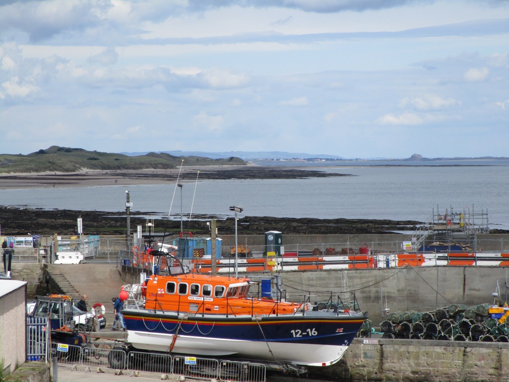
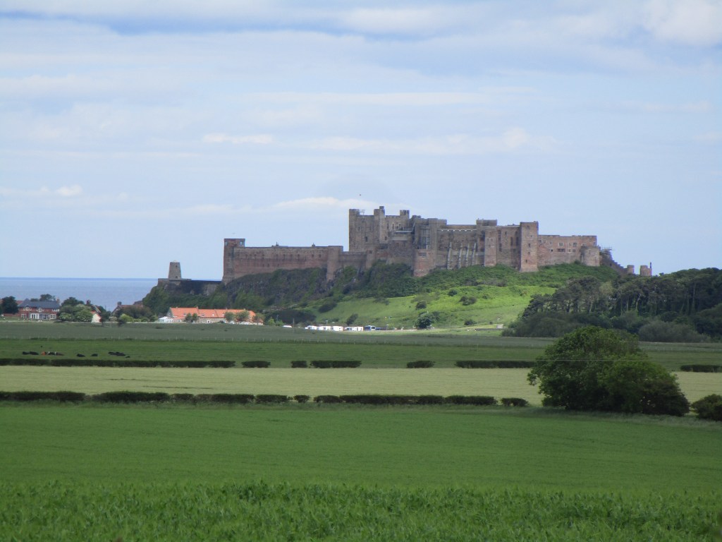
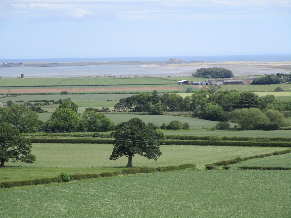
A boat full of tourists heads out of Seahouses towards the Farne IslandsThe Seahouses lifeboat with Bamburgh castle and Lindisfarne in the backgroundBamburgh castleLindisfarne and its mudflats
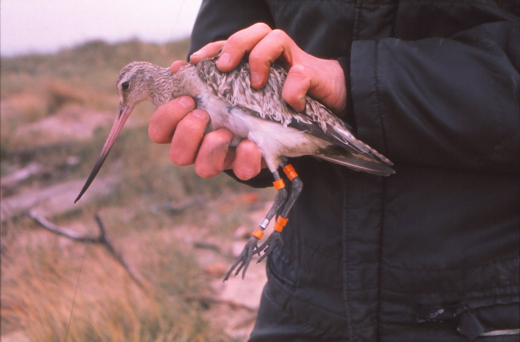
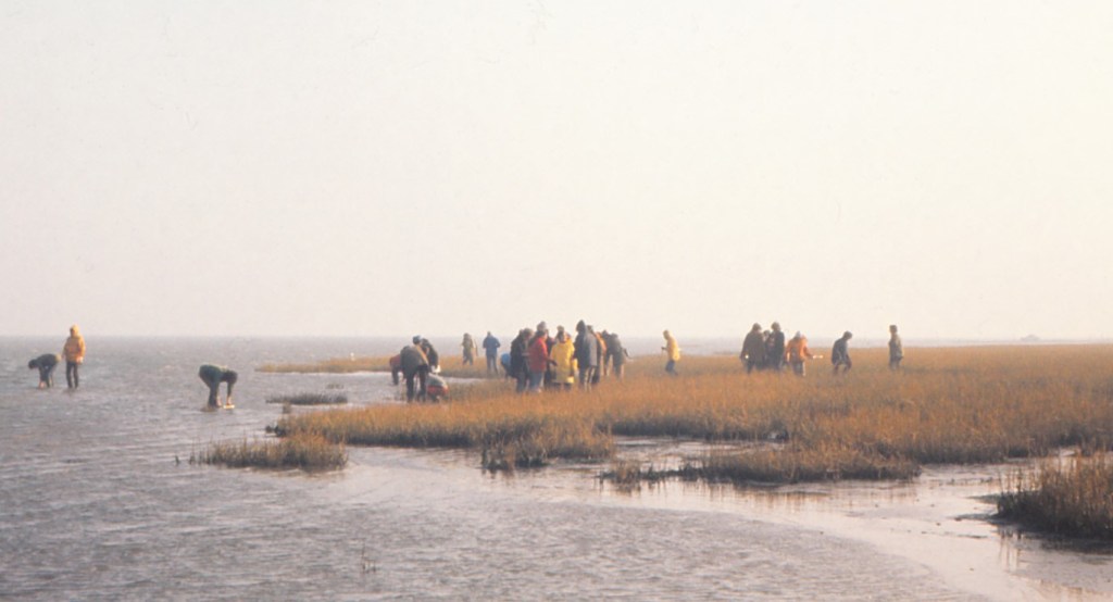
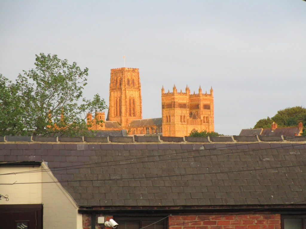
Some may have noticed that I said little about my ‘academic’ time at Durham. To be honest, I found most of the course work there in my time rather dull and uninspiring. I remember clearly having an argument with one lecturer about his lecture on territoriality that was at least ten years out of dates in terms of literature used and concepts described. Another lecturer seemed more interested in the young female students than in the job of imparting knowledge. One lecturer, Peter Evans, was though on my wavelength. One of his specialities was shorebirds and his students spent much time catching wading birds – I joined in, as I did with other ornithological field work with the Durham students. We also had undergraduate field trips – and this is my excuse to include this here – we once went to Lindisfarne mudflats.
Cannon-netting and marking a bar-tailed godwitField trip to a Lindisfarne saltmarshRocky shore field tripPat Monaghan examines a sample tray. I originally met Pat when I was working on Walney Island, was one of our post-graduate demonstrators – now a professor at Glasgow UniversityVacation expedition from Durham to Foula in the ShetlandsAlso on Foula, hi Bridget!
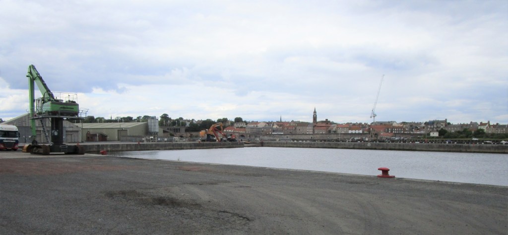
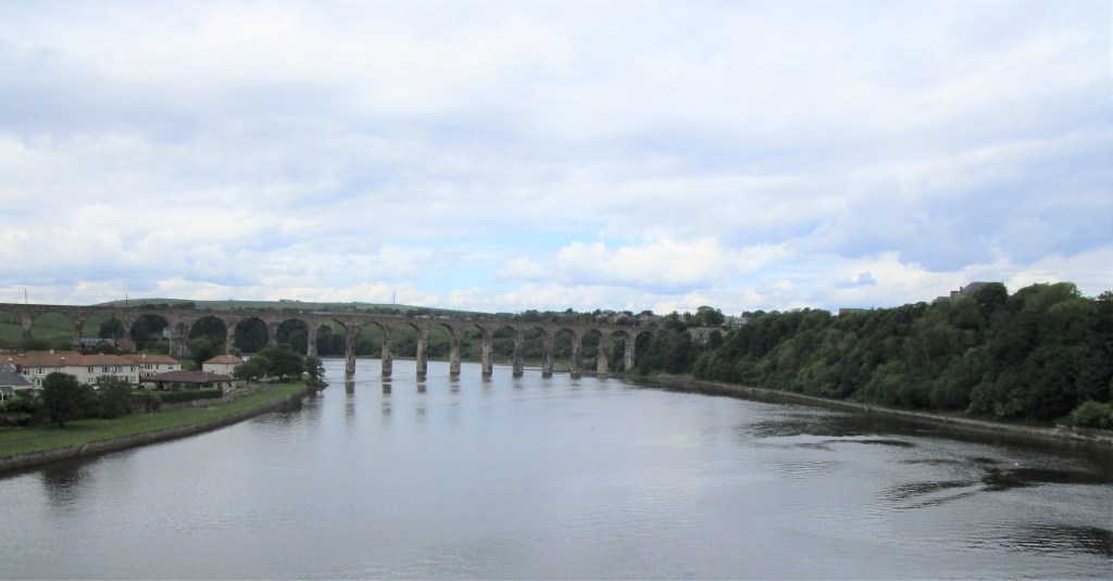
Onwards to Berwick-upon-Tweed. I had long thought the story of the town still being at war with Russia due to an arcane peace treaty not being complete was a nice story – but this afternoon’s research on Wikipedia finds that it is just that – a nice story but untrue!
Tweedmouth Dock used to be the home of our favourite ‘research’ vessels- the Ocean Bounty – in the early and mid 1980s – now deserted.The River Tweed
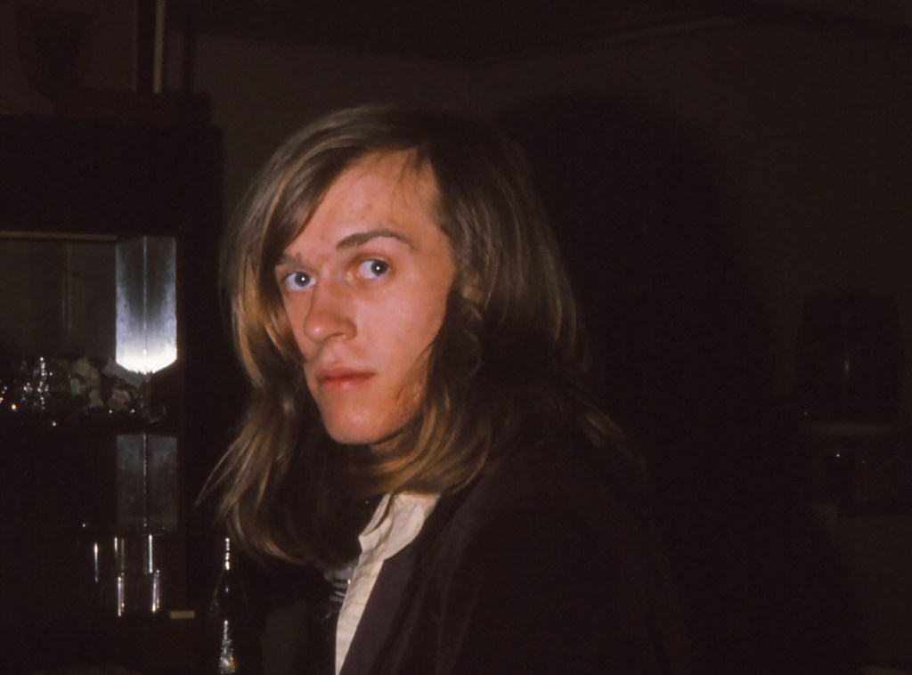
I did a very bad job of meeting up with people in Durham. Sadly my niece Emily who is just completing her degree had flu and was in bed (get well soon) and I met few folk from Durham years, mostly because I have lost touch. Not so Pauline and her husband (newly-minted) Professor Bob (congratulations). I called in on them for a cup of coffee this morning. We remembered old friends – one of whom we miss badly – Dave Isaac who decided several years ago not to carry on with life. He has also been on my mind since talking to that fellow long-distance charity cyclists about his charity – Suicide Prevention.
Dave – RIP
It was then onwards to Newcastle and beyond. I was riding in purpose built cycle lanes (or shared lanes) for most of the way until north of Newcastle. These are highly variable, so I thought I’d illustrate a few issues.
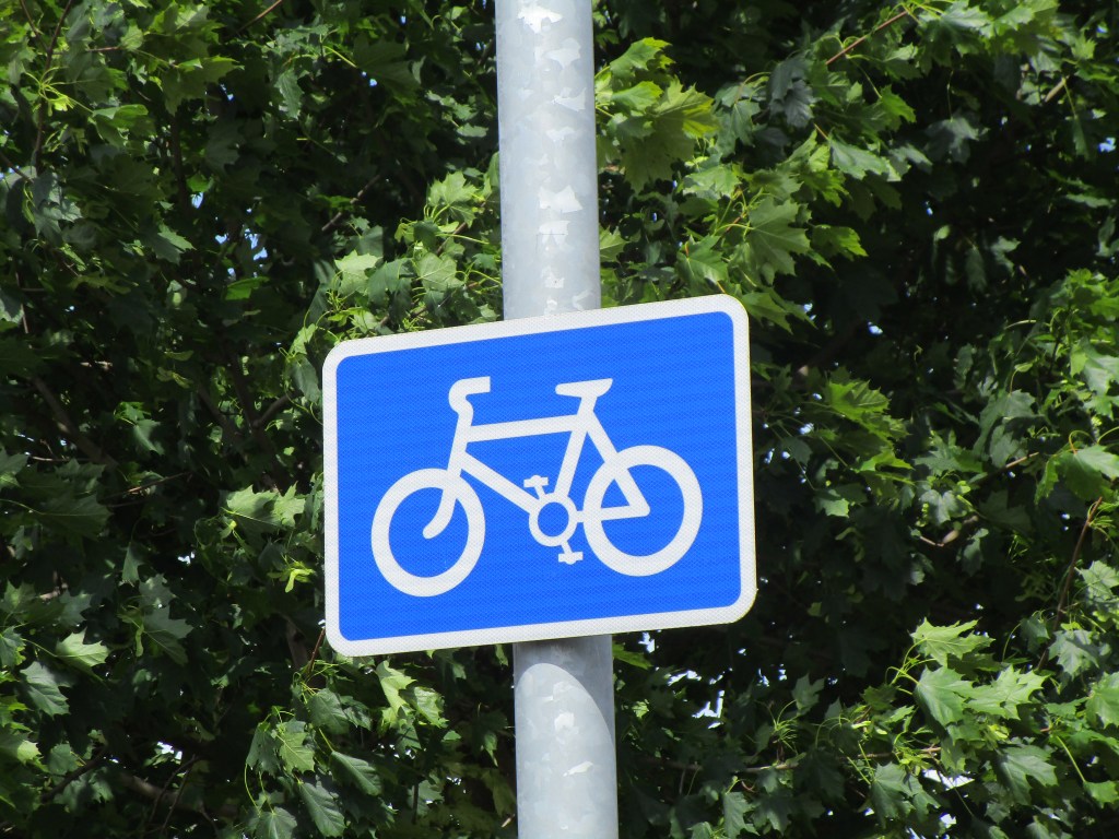
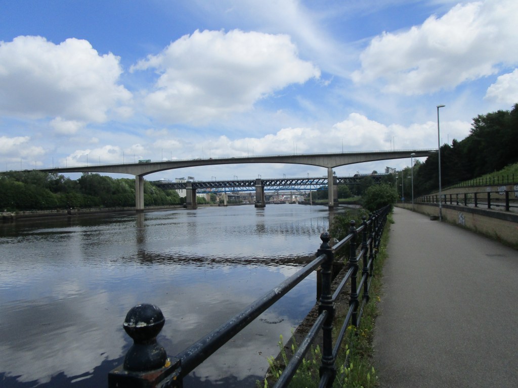
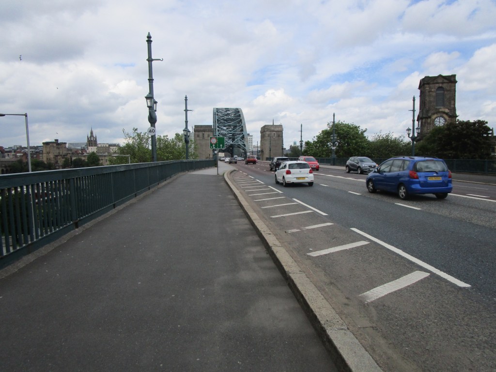
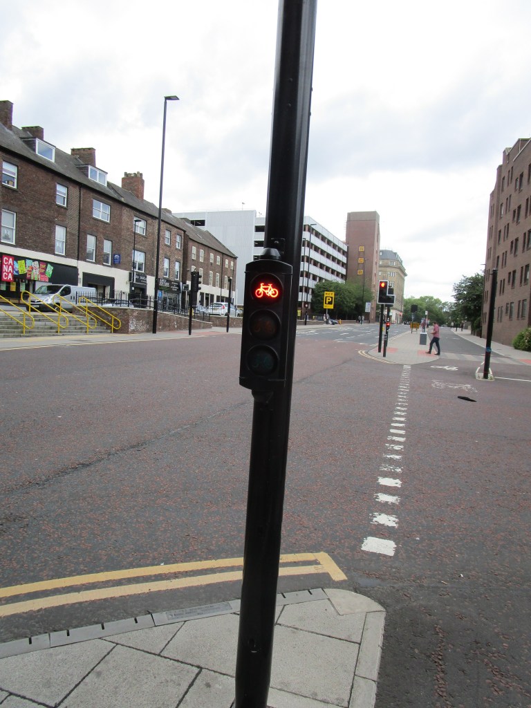
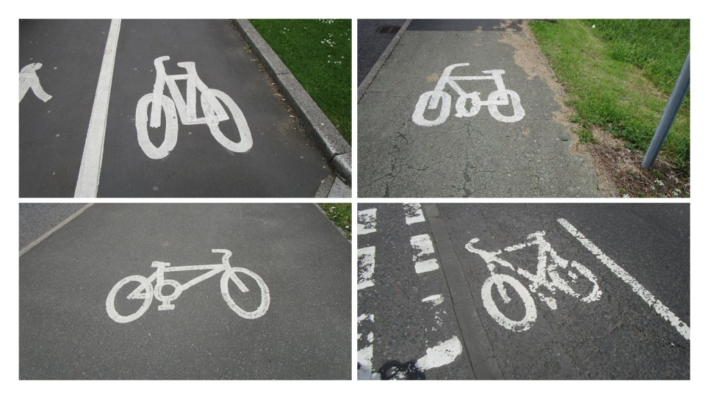
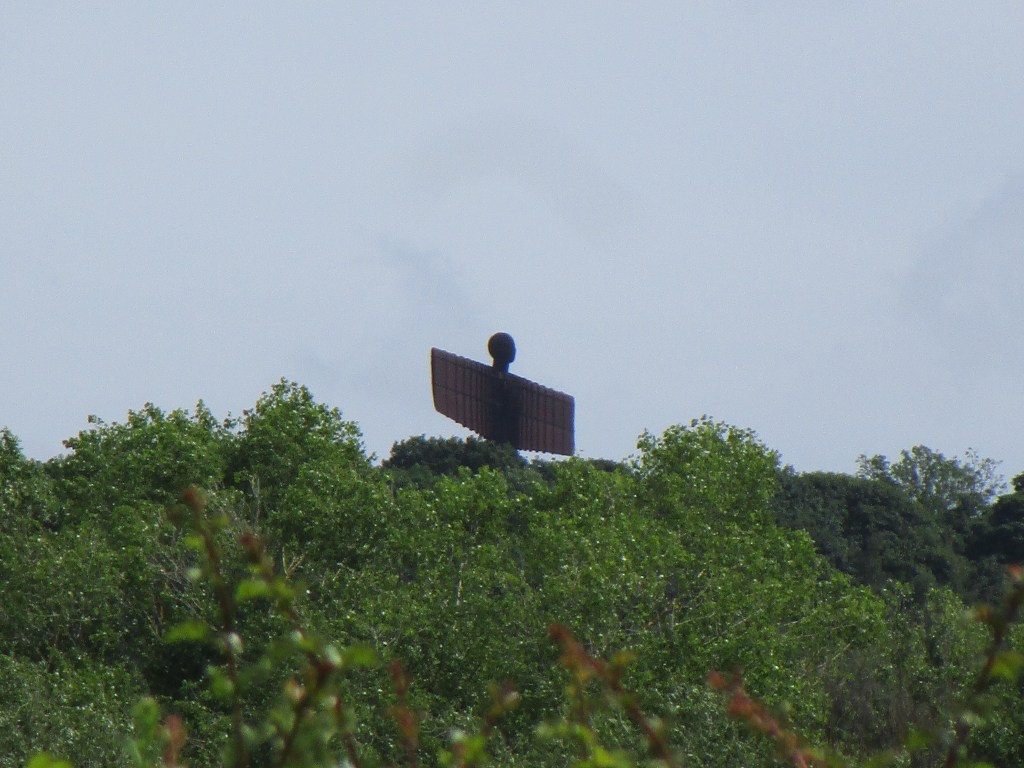
This sign seems to be used to both indicate a cycle lane and to warn motorists that there are cycles about whether there is a cycle lane or not. The art work is standardised.A great cycle path away from roads and nice and wide.The cycle path following the south side of the River Tyne. Motorised vehicles do not get this fine viewA wide cycle only path integrates with pedestrians when crossing the TyneProper cycle only lights are very welcomeThere are no parking spaces marked on the dedicated cycle lane, however some metal box owners feel they can park anywhere. In this case it was possible to cycle around the back of them, but sometimes this forces cycles out into traffic – exactly what the lane is meant to preventNot the best example, but vegetation hanging into cycle lanes (in this case including wild roses) also can force bikes into the trafficMuch appreciated wide cycle lane with dedicated lights.The variance in road marking keeps me amused. Plainly some artists have never looked at a bicycle, while others seem distinctly uncomfortable!Durham to AlnwickThe Angel of the North is impressive from all angles
Statistics for yesterday, today and cumulatively: 100 km, 89 km and 1971 km. Ascent: 1377 m, 759 m, 19602 m. I have lost track of the tubs at present – lots!